Craig Phadrig and its kings
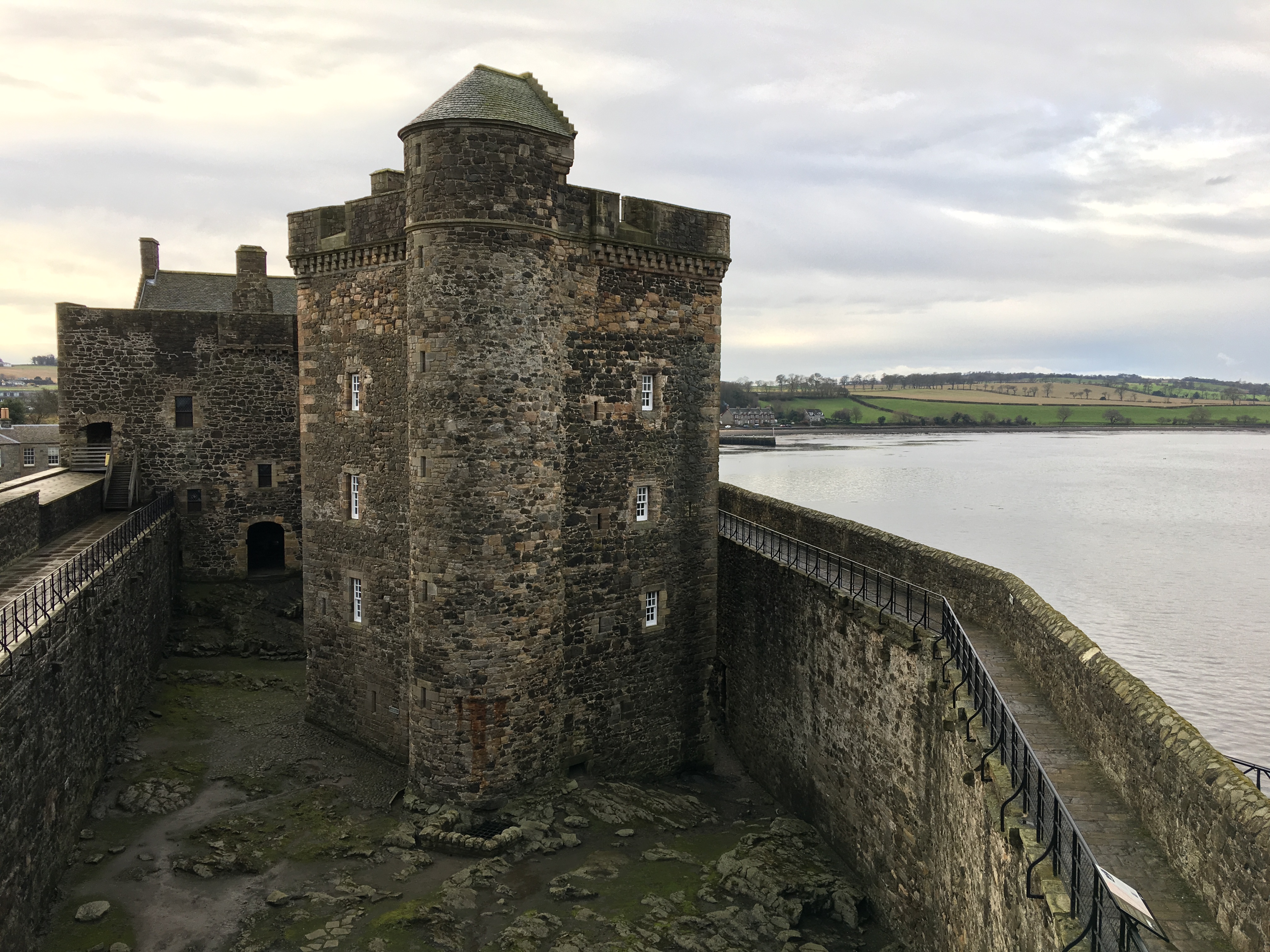
In my last blog post, which was about Urquhart Castle on Loch Ness, I mentioned that St Columba travelled up the Great Glen to visit Bridei mac Maelchon (also Brude or Bruide), a king of the Picts. It’s possible that St Columba made this journey more than once, and his first visit may have taken place in 565 AD*, two years after he and his followers had established their monastery on Iona.
According to St Adamnan, who was St Columba’s biographer, when St Columba arrived at King Bridei’s fortress he found the gate closed and bolted against him. Bridei, apparently, was keen to display his majesty and power. But St Columba made the sign of the cross, knocked on the gate and then laid his hand on it, upon which the bolts flew back and it opened of its own accord. At this surprising turn of events, Bridei hurried outside and greeted St Columba with the greatest respect. ‘And ever after,’ concluded St Adamnan, ‘from that day, so long as he lived, the king held this holy and reverend man in very great honour, as was due.’
No contemporary accounts reveal the precise location of Bridei’s fort, but it is mentioned as being ‘some distance, though not far’ from the banks of the River Ness, and St Columba had to climb a ‘steep path’ to get there. Historians have considered several possibilities, including Craig Phadrig, a hill fort on the western outskirts of Inverness; the Castle Hill of Inverness, located in the heart of the city and overlooking the River Ness; and the hill fort known as Torvean, a little further south than either of these but still close to the river.
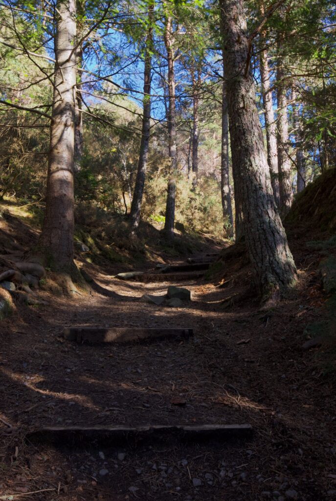
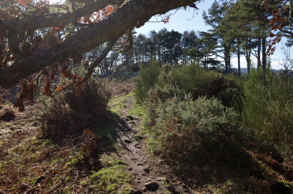
Of these, Craig Phadrig (or Creag Phàdraig, meaning Patrick’s Rock) seems to be the most popular option, judging by the information signs at the site. Before you set out on the trail from the car park, you’re encouraged to imagine that you’re walking in the footsteps of saints and kings, and to picture scenes such as a storyteller with his audience seated around the fire.
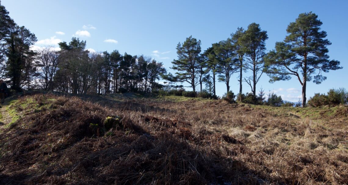
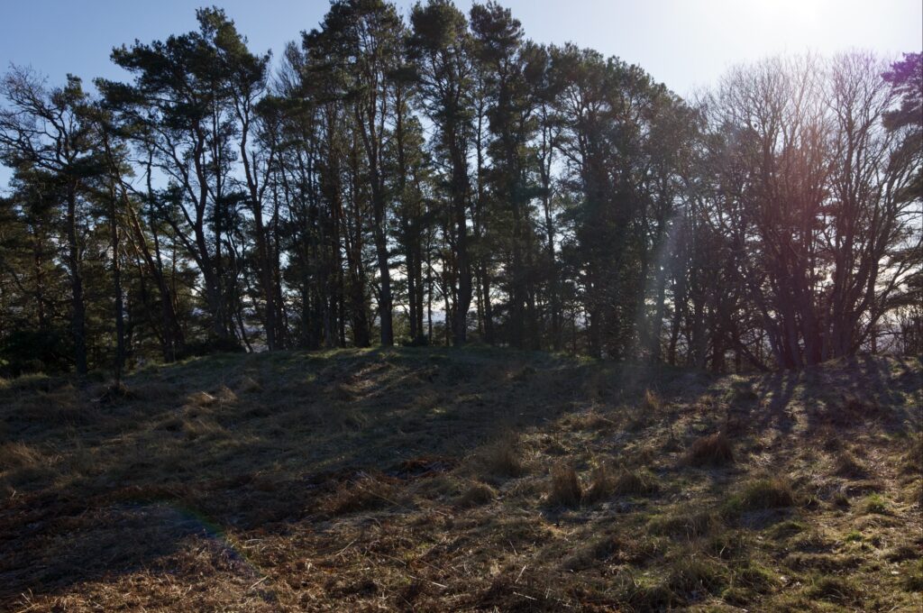
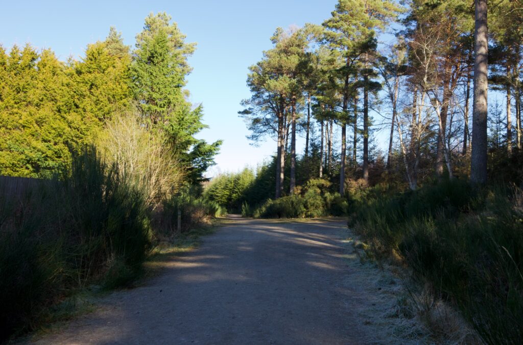 The place is obviously a popular spot for local walkers, with a number of well trodden paths leading off through the trees. On a cold but bright February morning, it was only a matter of minutes before we were climbing up the hill and emerging onto the bare summit. The highest part is formed by embankments – remnants of ramparts – which enclose a piece of land roughly rectangular in shape with rounded corners.
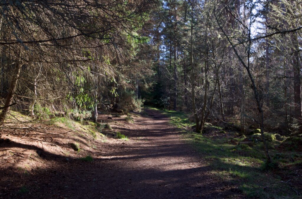
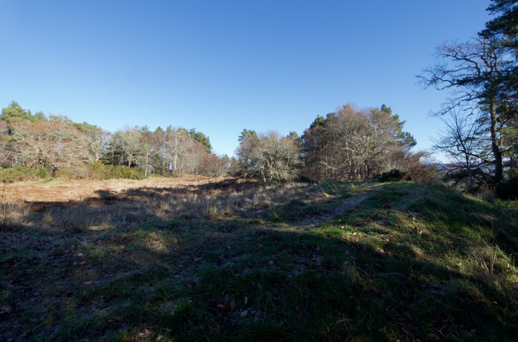
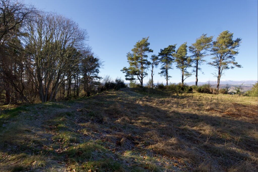
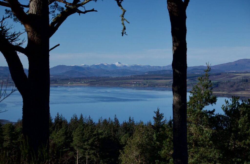
No trace survives of any buildings that might once have stood here, and the embankments have a thick cover of vegetation. The only way of seeing what the original occupiers of Craig Phadrig saw is to stand and gaze outwards, at the magnificent views across the Beauly Firth to the mountains beyond. We identified Ben Wyvis, but beyond that rose even snowier peaks that we couldn’t easily name. Tall trees now obscure an equally dramatic view to the north over Inverness and the Moray Firth.
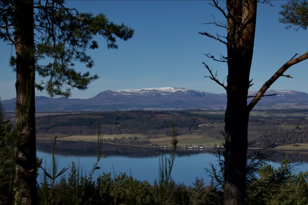
Above: Ben Wyvis (we think). Below: Unknown peaks – suggestions welcome
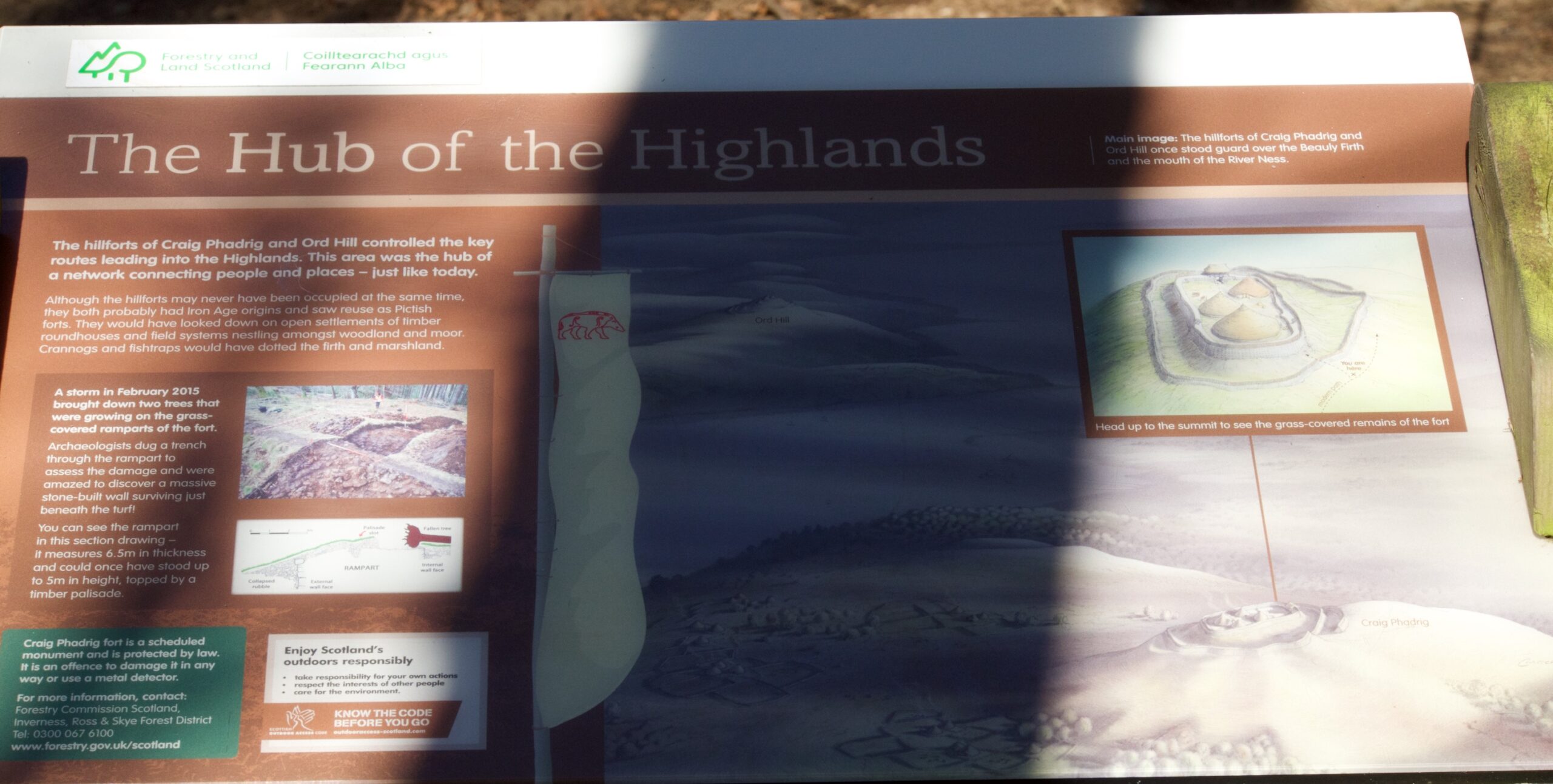
An information sign – awkwardly shadowed – offered an artist’s impression of the hill fort when it was occupied. Click to enlarge
Piecing together the chronology of Craig Phadrig’s occupation is much more difficult than you might imagine. The site has been excavated many times over a period of about 250 years, beginning in the 1700s. A survey published in 2014 by Forestry Commission Scotland and RCAHMS says: ‘The attention lavished on the fort in the 18th and 19th centuries by no doubt well-intentioned antiquarians has left a legacy of a site extensively stripped of its occupation deposits and with virtually no accompanying record.’ However, one of the more recent investigations, which took place in the 1970s, revealed human activity here during the Iron Age, and some sources suggest a date of around 300 BC. An article by the North of Scotland Archaeological Society puts this theory into context:
‘The Beauly Firth marked a southern boundary of an area defined in the north by the Dornoch Firth landscape, supposedly held by the Decantae tribe in the lron Age as shown in Ptolemy’s map. Knock Farrell and Ord Hill hillforts are in line of sight, and a third possible fort is at Torvean in Inverness.’
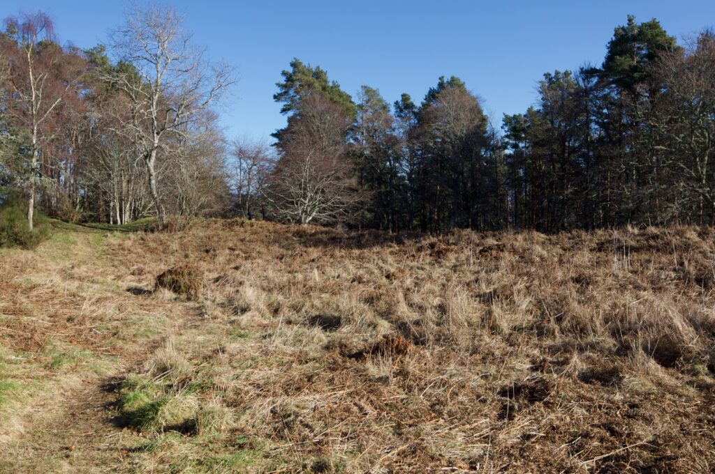
Standing in the interior
At some stage during its early history the fort was vitrified, in other words the stone used to construct it has reached such a high temperature that it has melted and turned into a kind of glass. Scores of other hill forts throughout Scotland contain evidence of vitrification, among them Dun Deardail in Glen Nevis, Tap o’Noth in Aberdeenshire, and Dun mac Uisneachan (Beregonium) in Argyll. The phenomenon also occurs elsewhere in Britain, as well as in Europe and the Middle East.
‘Through an open and lovely glen the river flows northward to the firth; the glen bounded by the green slopes of the Dunean ridge, crowned with a range of vetrified forts, and terminating in the round and wooded Craig-Phadrig; while over it, like a dim land of clouds, rise the wild hills of Strathglass.’
Scottish Journal of Topography, Antiquities, Traditions, &c., 1847
Vitrified hill forts have puzzled generations of scientists and historians. In October 1776, the antiquary Thomas West sent a sample of vitrified rock from Craig Phadrig to his friend Mr Lane, a member of the Royal Society in London. West, having examined the site in person, thought at first that he was looking at a volcanic crater, but the ‘smoothness of the inside’ left him in doubt. However, when his accompanying letter was published in the Philosophical Transactions of The Royal Society of London, a footnote was added: ‘The specimens sent with the above letter to the Royal Society, having been examined by some members well acquainted with volcanic productions, were by them judged to be real lava; and it was their opinion, that if a great quantity of the like substance be found on the hill from whence these pieces were taken, the hill most probably owes its origin to a volcano.’
It was later thought that, in order to achieve vitrification, a network of timbers was constructed around the walls and set on fire. However, experiments have shown that vitrification requires a temperature of at least 1,000°C (1,832°F) for a prolonged period of time. Such extreme temperatures would be very hard to reach merely by setting fire to wood.
In the 1930s, the archaeologist V Gordon Childe and his colleague Wallace Thorneycroft tried to recreate the conditions for vitrification. At a colliery in Stirlingshire, they built a wall of stone measuring 12 feet long by six feet wide, interlaced with pit props and faced with old clay firebricks. They filled the cavities with basalt rubble and covered the top with turf. Then they piled about four tons of timber and brushwood against the sides and set fire to it. Strong winds caused by a snowstorm conveniently fanned the fire to a strong blaze, and afterwards it was seen that the stones in the core of the wall did achieve some degree of vitrification. More experiments have since been conducted, but the required conditions seem to be so extreme and so specific that it’s hard to imagine how they could occur at a hill fort.
And assuming that vitrification was the result of human activity, why was it carried out? Some sources suggest it was done as a ritual after the fort was abandoned, thereby weakening the walls because they would become more brittle; others argue the opposite, that vitrification strengthened the walls and was a form of defence. And of course there are the possibilities of accidental fire, and deliberate torching by attackers. But you’re still left with the feeling that some vital element is missing.
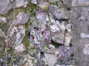
Vitrified rock (via Wikimedia)
I can’t help but think that dragons answer every question about vitrification. If dragons had turned up unexpectedly and set about breathing fire over a hill fort before moving on to another, this would explain the variations in dates as well as the frequent concentration of vitrified material around a fort’s entrance. Naturally, they would choose to stand there for dramatic effect. And what happened to all these ferocious dragons? I suspect they heard how St Columba dealt with the Loch Ness monster, and decided to quit while the going was good.**
Recent archaeological studies have shown that Craig Phadrig was reoccupied after it was vitrified. According to Archaeology for Communities in the Highlands, ‘it is only after this event [vitrification] that occupation layers were discovered by excavators dating to 200-300 AD.’ And it was still in occupation during the 5th and 6th centuries, which was the time of King Bridei and his meeting with St Columba.
In addition, there is tangible evidence of high status metal-working at Craig Phadrig, in the form of a clay mould for part of a hanging bowl. Because this and other finds have been dated to between 400 and 600 AD, it adds weight to the argument for Craig Phadrig being Bridei’s hill fort. But compared with other possible candidates, Craig Phadrig has been more extensively excavated. We might never know, for example, what lies beneath the mound on which Inverness Castle now stands. Historians have pointed to the cluster of significant sites to the east of the River Ness, which favour the Castle site over Craig Phadrig: among these are carved Pictish stones, a large Iron Age craftworking site, and a possible barrow cemetery.
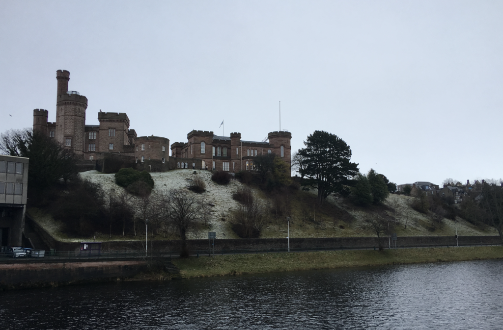 Inverness Castle, which sits on Castle Hill overlooking Inverness. Older castles have stood here but the present structure dates from the 1800s
 The Knocknagael Boar Stone, a Pictish symbol stone now on display at the offices of the Highland Council in Inverness
St Columba is said to have converted King Bridei and his people to Christianity, and many instances of his miraculous powers are cited by St Adamnan in his biography. He also clashed with a druid called Broichan, who, it seems, had similar powers but used them for dubious ends. Broichan refused Columba’s request to release a woman whom he had enslaved, so when messengers came to Columba with news that Broichan was ill and requesting a cure, Columba’s instructions were conditional upon his freeing the woman. Columba then handed over a small white pebble that he’d picked out of the River Ness; he told them to immerse the stone in water and then let Broichan drink from the cup. Broichan consented to release the woman, drank the water, and was healed instantly. King Bridei is said to have preserved the white pebble among his most treasured possessions, using it for healing on many other occasions, but it vanished mysteriously on the day he died.
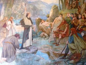
‘Saint Columba converting King Brude of the Picts to Christianity’, a painting by William Hole, c.1899
On another occasion, when St Columba was preparing to return to Iona, he fell into conversation with Broichan who asked him exactly when he intended to leave. On hearing that Columba meant to depart in three days’ time, Broichan declared that it would be impossible, because he could ‘make the winds unfavourable to thy voyage, and cause a great darkness to envelop you in its shade.’ Maybe Broichan was holding a grudge, or maybe he just wanted his new-found friend to stay a bit longer. St Columba ignored his threat, but the weather did indeed turn stormy, with a south-westerly gale blowing up Loch Ness. Unfazed, the saint calmly invoked the name of Christ, and to the astonishment of spectators the vessel sailed straight into the wind. Presently the storm subsided and the wind direction changed, so that Columba’s boat continued to carry him safely down the loch.
 Whether or not Craig Phadrig was the fort of a king, it’s safe to say that it was extremely well positioned, offering a distinct advantage to anyone wanting to control key routes into the Highlands. Information boards describe a landscape of woodland dotted with settlements of timber roundhouses, with crannogs and fish traps in the Firth and surrounding marshland.
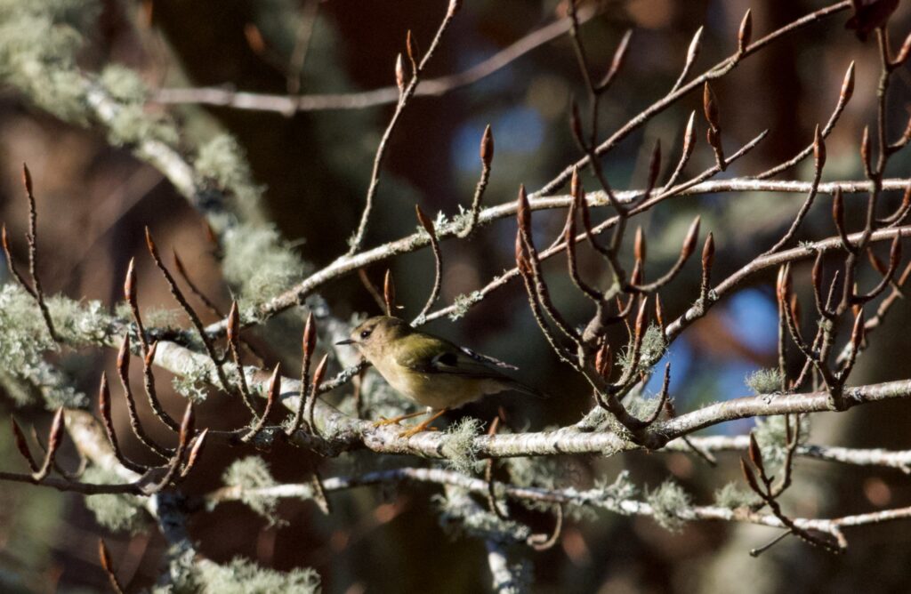
A footpath runs along the top of the ramparts, and as we walked along our attention was caught by some small birds in the tops of the Scots pines. These were goldcrests, hard to spot because they’re so restless, and they were flitting from branch to branch in search of insects. Their high-pitched ‘seeping’ calls came down to us, and we saw occasional flashes of the brilliant yellow stripes on their heads. And meanwhile, in the leaf litter under some gorse bushes, a wren was foraging busily, her plumage a perfect camouflage in the nut-brown shade.
Goldcrests were once known as golden-crested wrens, and their Latin name, Regulus regulus, means ‘little king’; they belong to the group known as kinglets. In folklore, the wren was the undisputed king of birds, hitching a ride on the back of an eagle to fly higher than everyone else. You can’t see or hear a wren or a goldcrest without stopping to admire it, and they absorbed most of our attention while we were there. I love how human kings have long gone from here, but the trees are alive with avian ones. Now, when I think back to Craig Phadrig, the wrens are what I’ll remember first. And possibly the dragons.
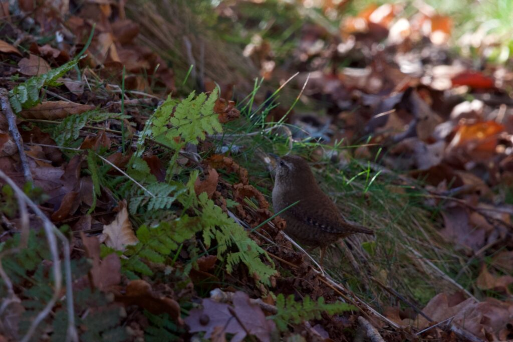
Wren (above) and goldcrest (below)
Footnotes
* There is debate about the exact year of St Columba’s first visit to Bridei. William Reeves, who published a translation of The Life of St Columba in 1874, suggests it could have taken place in 562 or 563 AD, ‘preliminary to the final settlement’ of Iona.
**I do know that there’s no historical evidence of dragons. As they used to say in the Iron Age, please don’t roast me.
Reference and quotes
- Craig Phadrig: Atlas of Hillforts of Britain and Ireland
- Forestry and Land Scotland
- Forestry Commission Scotland and RCAHMS: Craig Phadrig, Inverness: Survey and Review (PDF, Oct 2014)
- The Life of St Columba, trans. William Reeves (1874)
- Archaeology for the Communities in the Highlands: Craig Phadrig vitrified hill fort
- An Account of a Volcanic Hill near Inverness. In a Letter from Thomas West, Esq. to Mr Lane, FRS, Philosophical Tra’nsactions of the Royal Society of London, 1777
- Highland Historical Environment Record
- North of Scotland Archaeological Society: Craig Phadrig Vitrified Hillfort, Inverness
- North of Scotland Archaeological Society: The Location of King Bridei’s Fort (Fiona Campbell-Howes)
- HES: Knocknagael Boar Stone
Photos copyright Colin & Jo Woolf

11 Comments
Douglas Murray
Ben Wyvis for sure.
The one below could be Sgurr Mor Fannich, or Sgurr a’Mhuilinn (or the ridge of) above Strathconon ..
Jo Woolf
Thank you! Sgurr Mor makes sense, looking at the map – I can see the windmills in front and to the right of it, which were in our line of sight.
Bob Hay
Re the vitrified forts Jo. I don’t know why there is still so much controversy about how they were produced after Erich von Danniken proving they were the result of a nuclear war between aliens.
Archaeologists can’t think outside the box, they are such stick in the muds…no pun intended.
Jo Woolf
😂 Haha, it would be a much simpler explanation, Bob!
David Oakes
Thanks
David Oakes
As always a great read….only scan read it but have bookmarked it to read more leisurely 🙂
Jo Woolf
Thank you very much, David! There was a lot more to say about it than I expected (as usual!) A lovely place to explore.
Richard Miles
What a fascinating blog Jo. Because of my Scottish and Irish connections I have always been interested in St Columba and his travels which helped at school when I wasent otherwise .bothered with religious history,although I am now.
Do you think Tolkien got his idea of hobbits and humans hitching rides on the back of giant eagles from the folklore you mentioned about wrens and goldcrests also travelling around on eagles backs?
Tolkeins stories are heavily influenced by Celtic and Scandinavian,mythology,folklore and language,so I wouldn’t be surprised at all.What an amazing scholar he was.
Jo Woolf
Thank you very much, Richard. That’s an interesting point about Tolkien. The story of all the birds having a contest to see who could fly highest is apparently found in Ireland, France, Germany, Norway and Scotland, and the rivalry between wren and eagle is mentioned by Greek philosophers. I’d say no doubt Tolkien knew of it. You’re right that he was an amazing scholar, with such a wealth of knowledge to draw on. To invent languages, as well, and give them all histories and mythologies – just incredible. It’s as if he had lived in another time frame.
Finola
Loved this post, Jo, and all the mythology, to which I also see lots of parallels in Irish mythology – not surprisingly. I hope your tiny hands weren’t frozen too long.
Jo Woolf
Thank you, Finola! I love the mythology too, and it’s interesting to know that you can see parallels in Ireland. Luckily the wind wasn’t too cold that morning, although there was still frost on the ground. We’ll all be really glad when it warms up a bit!