
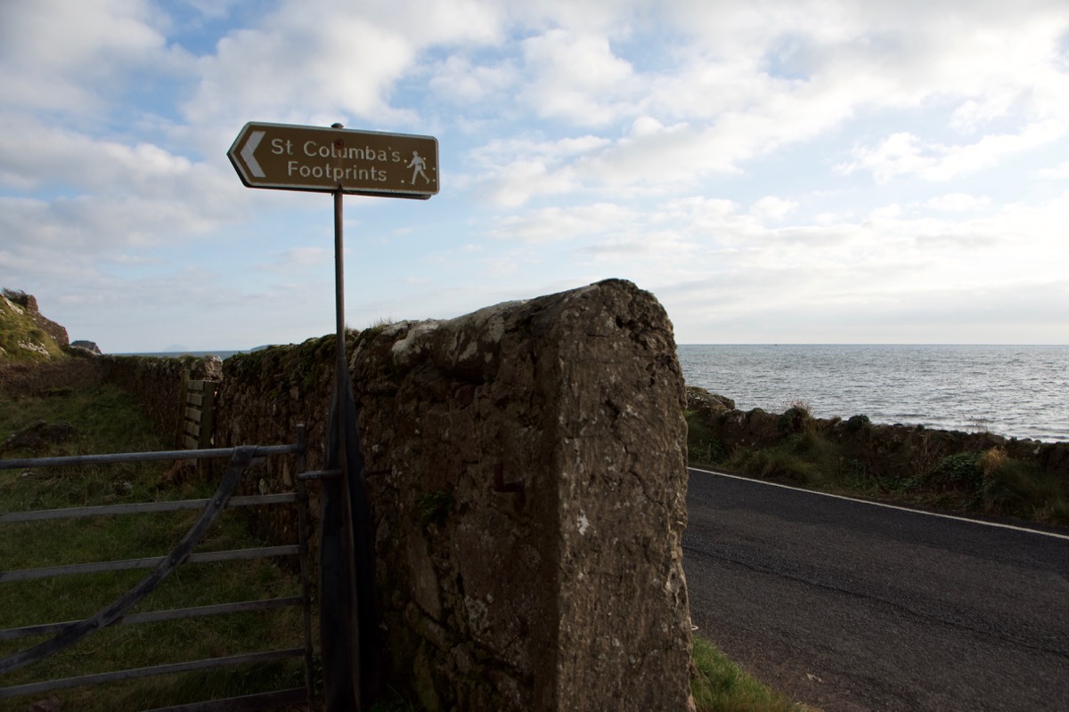
Dunaverty and St Columba’s Footprints
On Saturday the forecast was for bright sunshine all day, and this was such an unusual and auspicious event that we felt we had to make the most of it.
But where to go? It seemed like a long time since we’d been to Kintyre, and I remembered reading about a hill fort, quite similar in size and era to Dunadd, right at the southern tip. The possibility of seeing some divers and waders in the bays, along with some good waves after the recent storms, clinched the matter. South it was, through Lochgilphead, Tarbert and Kennacraig and then down the long road to Campbeltown. From Campbeltown, we drove another ten miles to the aptly-named village of Southend.
We tried to recall the last time we’d been here. It must have been 1983, or thereabouts, in a battered but much-loved Mini. The weather was appalling, I do remember that. In pouring rain and low cloud we tramped up some steps to see St Columba’s Footprints, and I was decidedly unimpressed. I’m not sure if I was also expecting to see St Columba there, fresh from having made them. There was no view to look at and we took no pictures, because this was the time when you saved your film for sunny days.
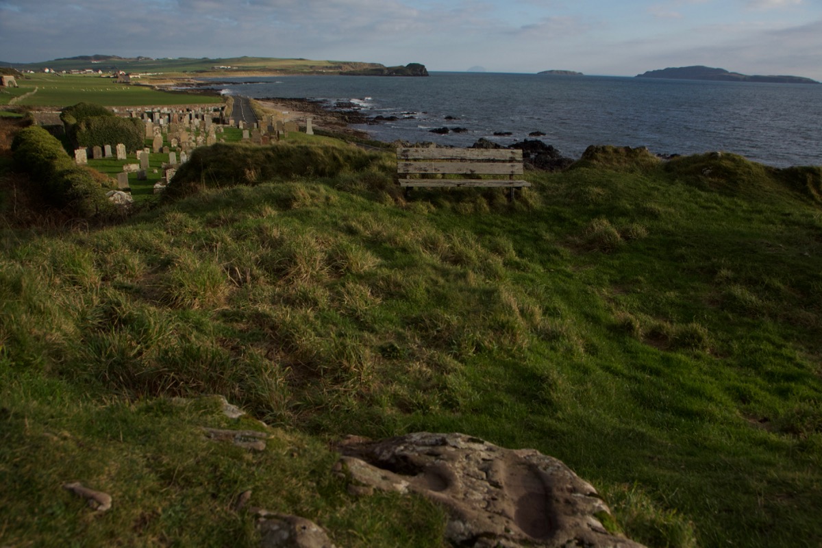
 Fast forward to the present, and the prospects were undoubtedly better. Better weather, better camera equipment, and a better appreciation for historical sites. The footprints were still there, and who knew that they overlooked such a wonderful seascape? As the name suggests, local tradition attributes one of them to St Columba, who is said to have landed here in 563 AD with his band of faithful followers.
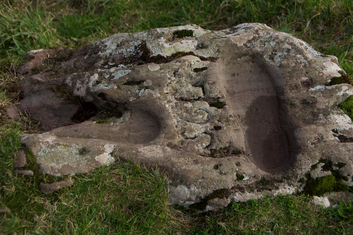 And the second carving? It is said that, in 1856, a local stonemason named Daniel McIlreavie chiselled another footprint, perhaps in an attempt to embellish the story, or to reassure visitors that Columba did, in fact, have two legs. The trouble is that, even though the ‘real’ one (on the left) has been eroded somewhat, they look quite similar. It’s hard to believe that there should be 1,300 years between them. To make things even clearer, McIlreavie added the erroneous date of 564.
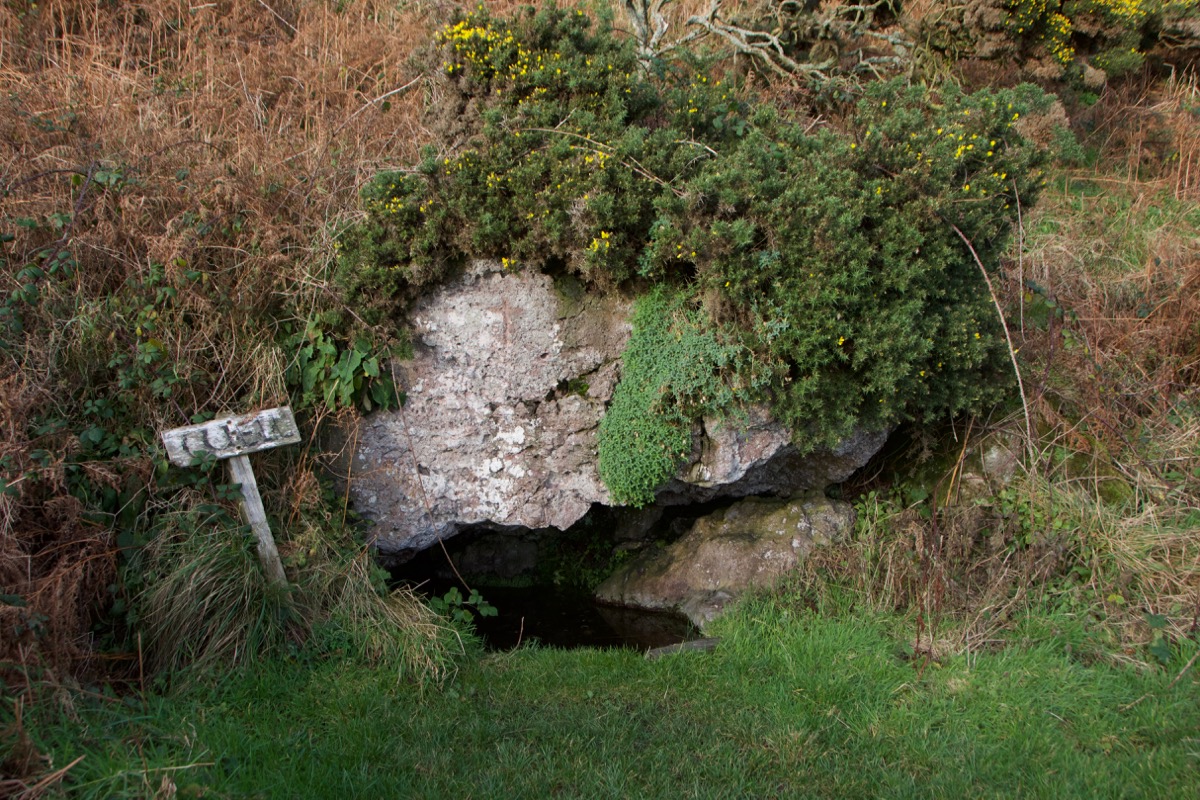
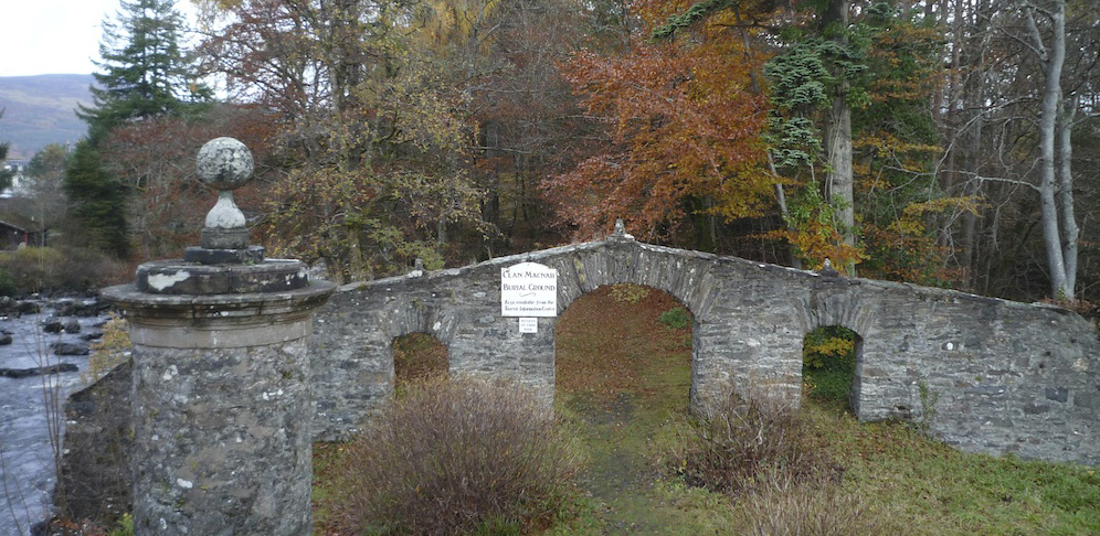
Nearby are the remains of a small chapel dedicated to St Columba, and a little further on, tucked away beneath some gorse bushes, is a holy well. So many of these old hallowed places are close to natural springs, which no doubt were imbued with healing powers long before the arrival of missionary-saints from across the water. As for St Columba, it is said that he didn’t linger here because he could still see Ireland. He had embarked on a mission of ‘white martyrdom’, distancing himself physically and spiritually from his homeland; he eventually settled in Iona because this tiny island was sufficiently remote from everything he held dear.
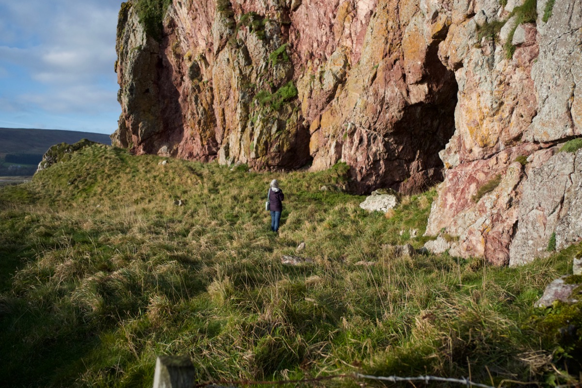
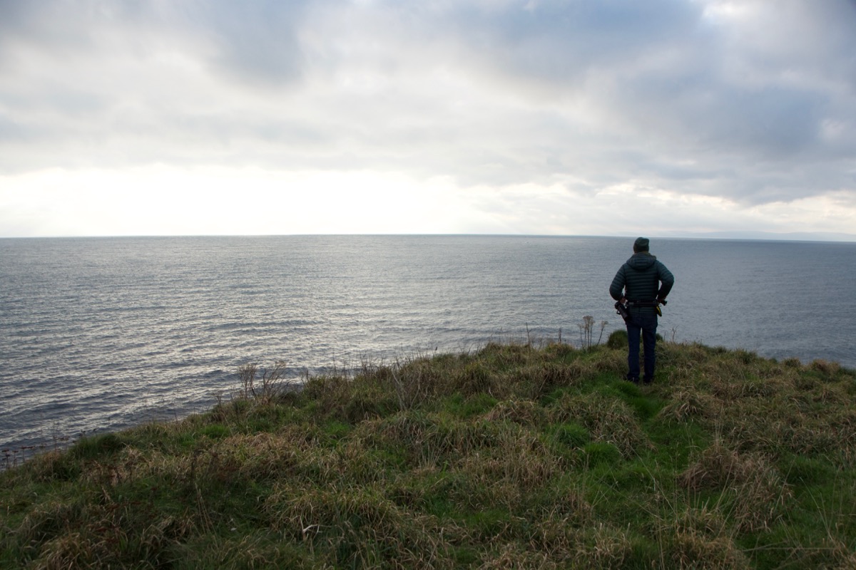
 Just to the west of the footprints, at some time or another some impressive cliffs have been eaten away by the sea around their base, resulting in a number of caves. They are haunted by rock doves: fitting residents, when you consider that St Columba’s Gaelic name was Colum Cille, ‘the dove of the church’, and the cill element arises from the word for a hermit’s cell. Their feathers and droppings lay scattered about, while the doves themselves wheeled and banked in the blue sky overhead.
 The caves have a long history of occupation. When the largest was excavated, it yielded evidence from the Iron Age, Dark Ages and early Medieval era. Even in 1881, it was home to a tinsmith called John McFee, as well as his wife, son, and extended family. Nearby, the Piper’s Cave is so named because it is said that a piper, making his way home one evening, ventured in there and disappeared forever; occasionally his ghostly piping can be heard in the dead of night. Is the entire landscape of Scotland haunted by forgetful, stranded pipers? Or did someone happen to hear something eerie in there, and latch onto the most plausible explanation?
Although they are dripping with rainwater, the caves are now well clear of the highest tides – evidence of a dramatic drop in sea level, like the abandoned stacks, arches and raised beaches that we’ve seen elsewhere on the coast of Argyll.
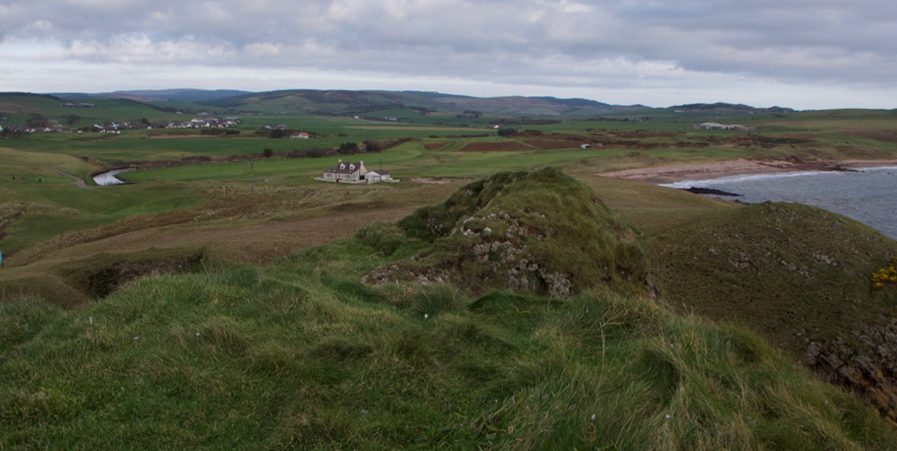
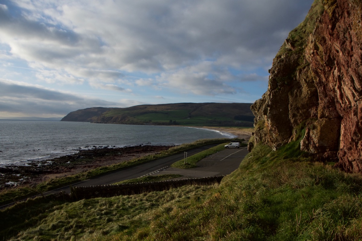
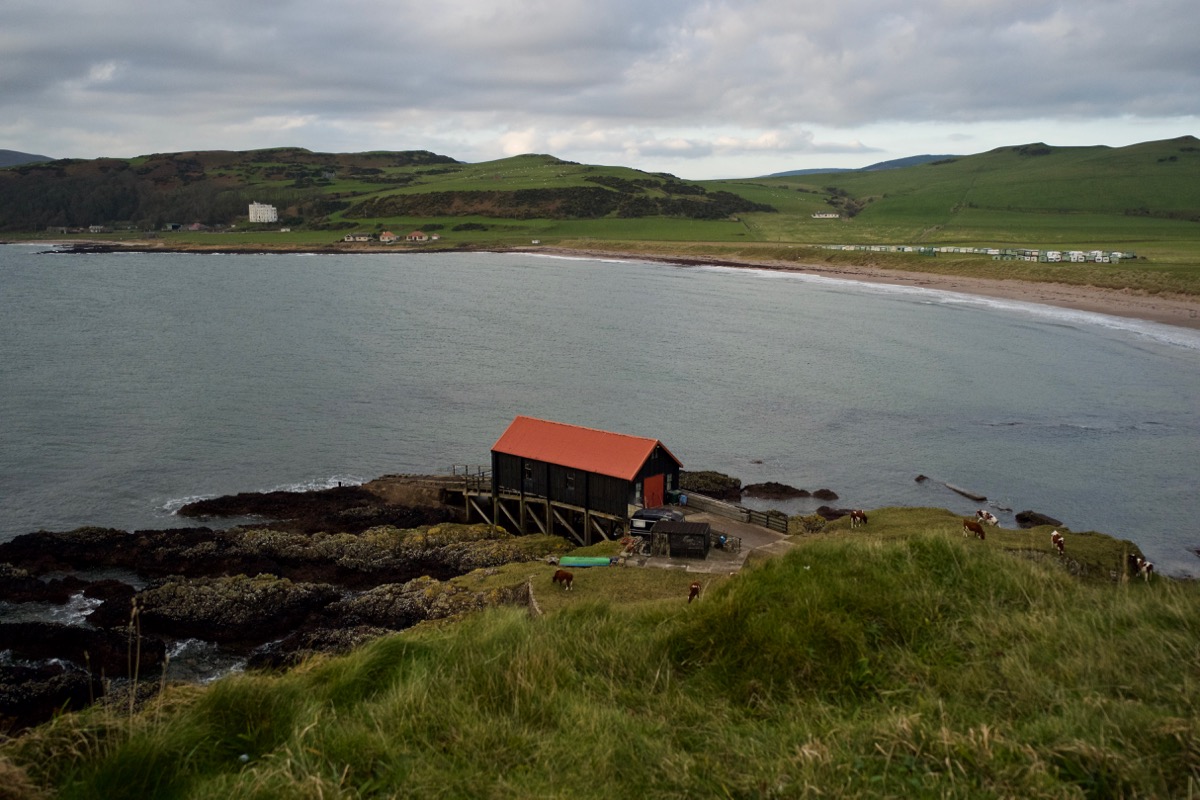
 The same cannot be said of Dunaverty, whose jagged outline we could see across the bay. Sea-washed it most certainly is, and quite dizzyingly so. We made our way along a rough track through some golf links to the foot of the promontory, and debated on the best route to take to the summit. A herd of cows were milling around two red-brick cottages and some farm buildings; there was no one in sight, but a sign on the gate assured us that visitors were welcome. We picked and clambered our way up the path, navigating some near-vertical sections, before emerging onto a surprisingly flat grassy platform.
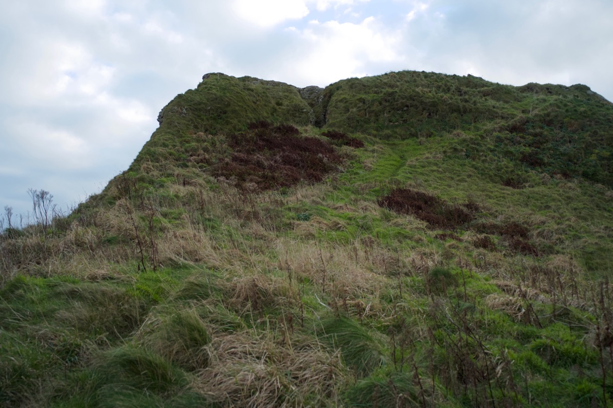
 If a castle had once stood here, it must have been small, at least in its ground plan. And it must have been pretty weather-resistant, out of necessity. The wind was comparatively light, and I tried to imagine what it was like up here in the grip of a storm. Spectacular, bracing, noisy, terrifying. It would be nice if history had preserved the journals of the people who lived in these places. I hoped they had warm fires and lots of candles.
So what do we know about Dunaverty?
The name is said to derive from the Gaelic Dun Abhartaigh, meaning ‘the Fort of the Abhairtach tribe’.
In the time of the kingdom of Dál Riata, which flourished from about 500 AD until the mid-ninth century, Dunaverty is thought to have been the power centre of a dynasty called the Cenél nGabráin, or ‘kindred of Gabrán’. Gabrán was their ruler, and his ancestry is immersed in legend; he is said to have descended from a leader called Fergus Mór mac Eirc. Literature, including the eighth-century writings of the Venerable Bede, describes the arrival of Fergus from the land that is now Antrim in Northern Ireland, but as yet no firm archaeological evidence backs it up. An alternative theory is that the people of Dál Riata held territories on both sides of the Irish Sea for much longer than we originally thought.
There were other dynasties in Dál Riata, and they competed fiercely with each other for the honour of over-kingship; there were repeated clashes, and possession of power passed regularly from one dynasty to another. In 712 AD, warriors from the Cenél Loairn dynasty, spearheaded by a leader called Selbach, burned a fortress of the Cenél nGabráin at Tarbert and then sailed around the Mull of Kintyre to lay siege to Dunaverty. Having effectively quelled the Cenél nGabráin, Selbach became the overlord of Dál Riata. But in those times lives were short and brutal, even for kings. You wonder how they ever slept.
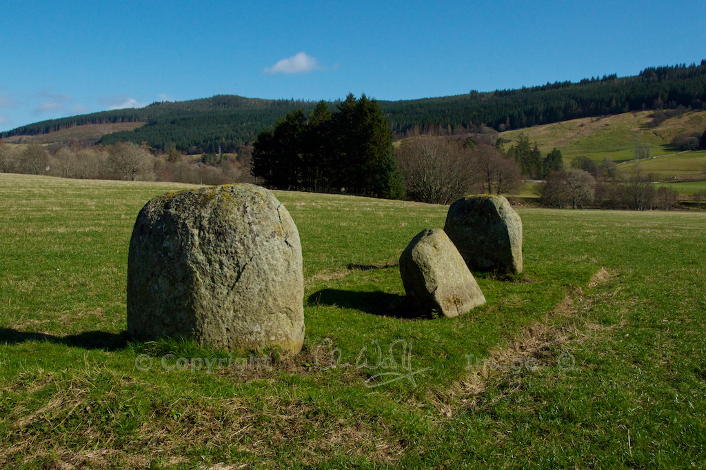
 The presence of a rock-cut footprint so close to Dunaverty cannot fail to inspire comparisons with Dunadd (right), another Dalriadan fortress, where a ‘king-making’ rock on the summit bears a similar carving. Here, in an ancient ritual, the new ruler would place his foot in the carving and swear an oath of allegiance to his people. St Columba is believed to have been present at some of the Dunadd ceremonies, in an official or religious capacity. If the footprint near Dunaverty was indeed used by the ruler of the Cenél nGabráin, it was certainly in a good position, elevated enough to impress a gathering of loyal subjects.
In the 13th century, Dunaverty castle passed between English, Scots and Norse rulers as these powers struggled for supremacy in the west of Scotland. Robert the Bruce, on the run from English forces, took refuge here temporarily in 1306 before going into hiding from his enemies. During the 15th century the MacDonalds, Lords of the Isles, lost the fortress to James IV of Scotland and it later passed to the Campbells. Its defences were sufficient to repel an attack during Henry VIII’s ‘Rough Wooing’ of Scotland in the mid-1500s, but its darkest hour came in 1647, during the Wars of the Three Kingdoms, when between 200 and 300 Royalist soldiers, mostly made up of MacDonalds and MacDougalls, held out at the castle in the face of besieging Covenanter forces. With their water supply compromised, the Royalists agreed a truce and surrendered, only to be massacred by their opponents. A handful survived, including the infant Ranald MacDonald, son of Archibald MacDonald of Sanda. According to tradition, he was smuggled out by his nurse, Flora MacCambridge, wrapped in a Campbell tartan. This was a successful ruse because Archibald Campbell, 1st Marquess of Argyll, was a key figure in the Covenanter movement and many of the besieging soldiers were Campbells.
 I’m quite glad that I didn’t know about this awful episode when I was standing on the top of Dunaverty. If there were 300 people here, they must have been severely crammed in. In the light of Scotland’s history, I thought I’d got used to reading about horrible deeds beneath every blade of grass, but apparently not. As we passed through the gate and thanked the cows for their hospitality, I glanced back and saw a kestrel hovering over the summit. Tail perfectly fanned, eyes intent on the ground, it was balancing on the wind more skilfully than any man-made artefact. In that moment, I preferred it to all the birlinns that I’ve never seen, with their cargoes of war.
References and further reading:
- ‘The Makers of Scotland – Picts, Romans, Gaels and Vikings’ by Tim Clarkson
- ‘A History of Scotland’ by Neil Oliver
- Castles, Forts, Battles
- Canmore – Dunaverty
- Canmore – Keil Cave
- Undiscovered Scotland
Images © Colin & Jo Woolf
10 Comments
Polite Scouse
So explicit with a touch of adventure. I always enjoy your travel log. Enjoy the festive season.
Jo Woolf
Thank you! That’s so nice to hear, and very kind of you. Have a happy festive season yourself!
Ashley
Another wonderful post! Thank you Jo! I really want to visit the area when restrictions are lifted and better health allows!
Jo Woolf
Thank you so much, Ashley! It was another interesting adventure for us too! I hope you can get down Kintyre way – it is a bit of a long haul but worth it!
Marie Macpherson
What a fascinating post with loads of info and gorgeous photos. Makes me homesick for the west. Many thanks again, Jo,
Jo Woolf
Thank you very much, Marie! It was good fun to go back down there and re-visit these old places! I hope you can come out to the west very soon. xx
MOIRA GOODMAN
Wonderful history Jo and spectacular photos. Beautifully written as always.
Must visit there sometime. xx
Jo Woolf
Thank you, Moira! I think you’d enjoy a visit there! Hope you are all well, love to all xx
Dave Armitage
Fantastic post, great pics such a joy to read and be inspired,
Jo Woolf
Thank you very much, Dave, that’s very kind! I’m glad to hear these places inspire you!