
Looking for the Rock of the Dead
If you’ve been following my blog for a long time, you may remember that about four years ago (is it really that long?) I wrote about Glen Lonan and the long-held tradition that it was known as ‘the Road of the Kings’.
The Road of the Kings… and the Rock of the Dead
From the ninth to the eleventh centuries it is believed that most of Scotland’s kings were buried on Iona, the sacred isle of St Columba. Royal funeral processions would have travelled west, from (for example) Forteviot in Perthshire. Passing down Glen Lonan, it’s likely that the cortege would then have turned south towards Loch Nell and Kilmore, which lies at the head of Loch Feochan.
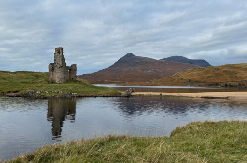
On the shore of Loch Feochan is a rock known as Carraig nam Marbh, ‘the Rock of the Dead’. Here, so it is said, the King’s body was placed in a galley and taken across the Firth of Lorn, around the southern part of Mull and finally to Iona.
Until just recently, I had a fairly good idea where Carraig nam Marbh might be, but I had not tried to locate it. A week or so ago I decided it was time to go and have a proper look.
There’s only a brief mention of the site in the Canmore database, but the accompanying map appears to show it quite precisely as an outcrop of rock on the south side of the loch, just below the turn-off to Kilninver.
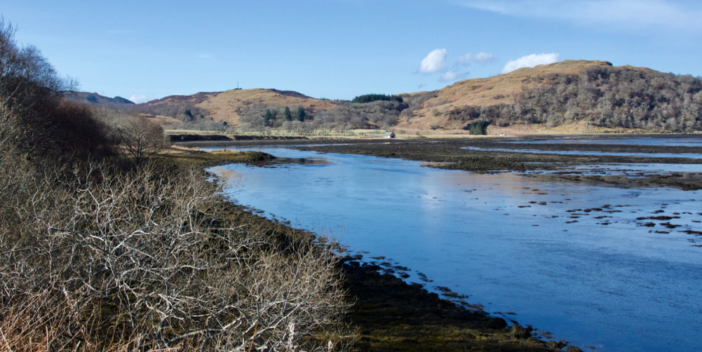
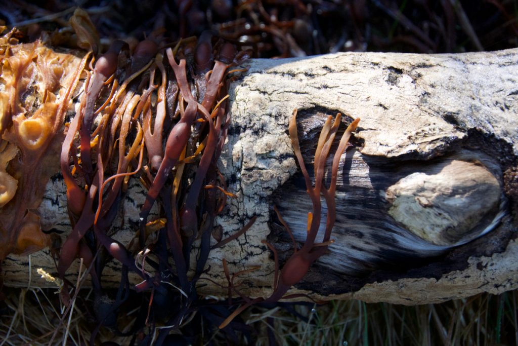
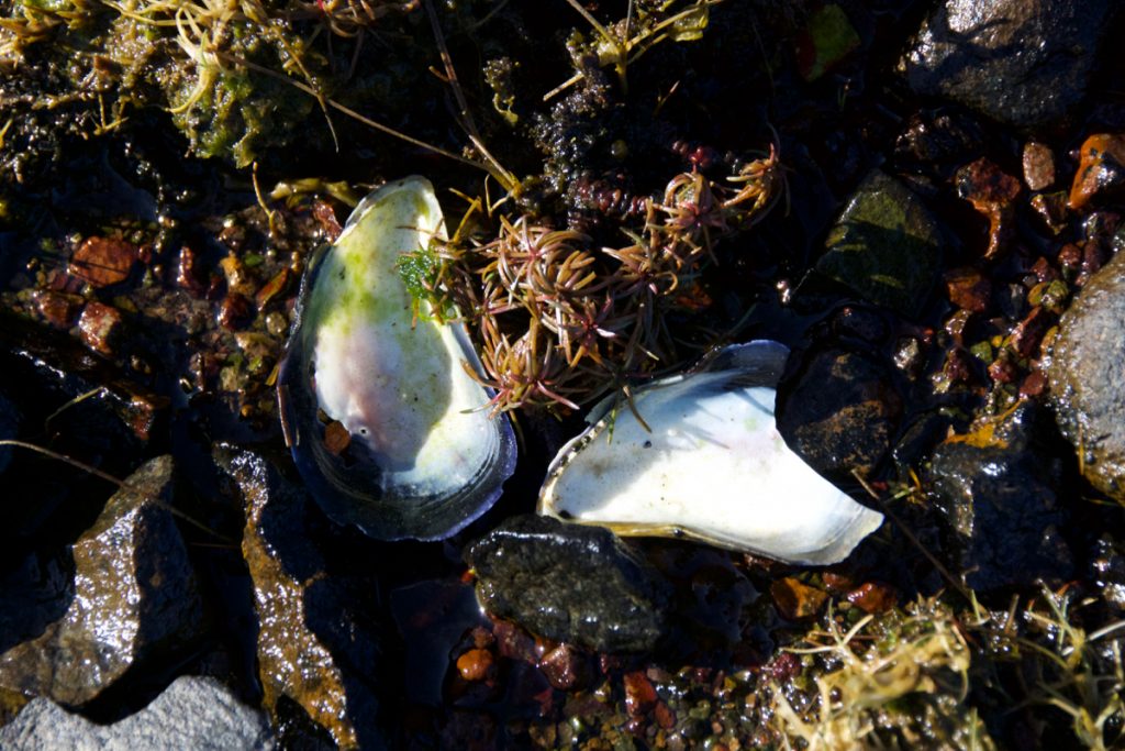
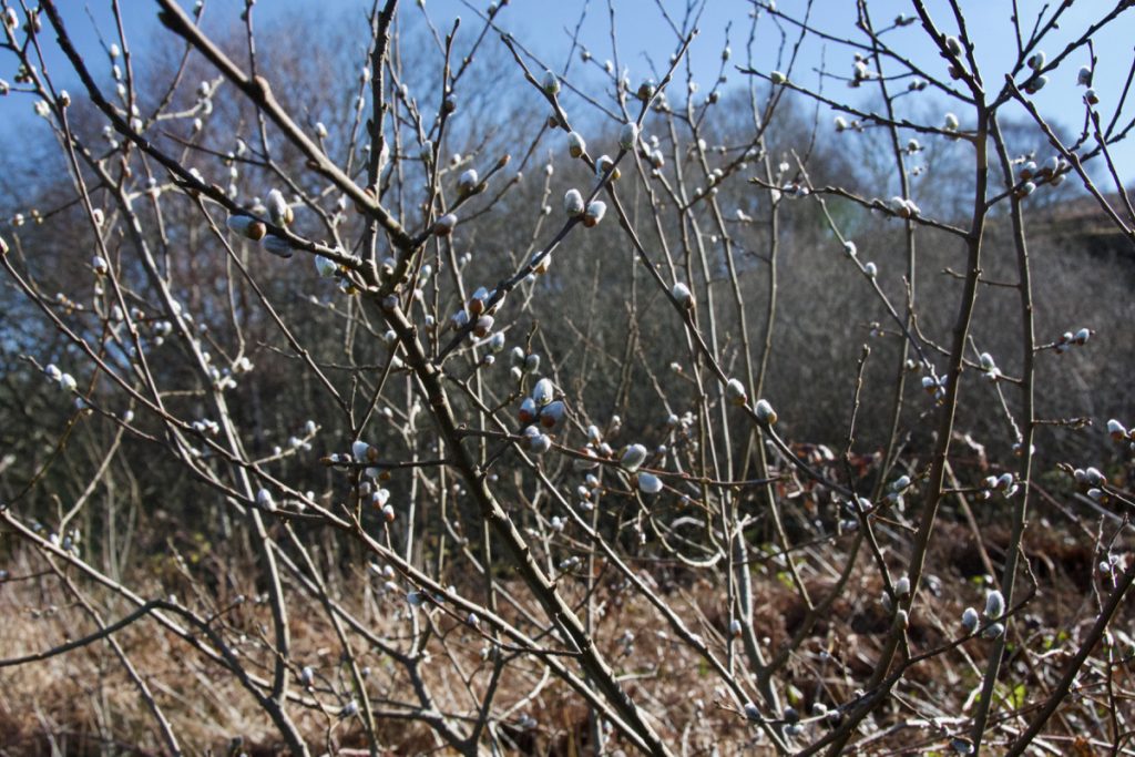
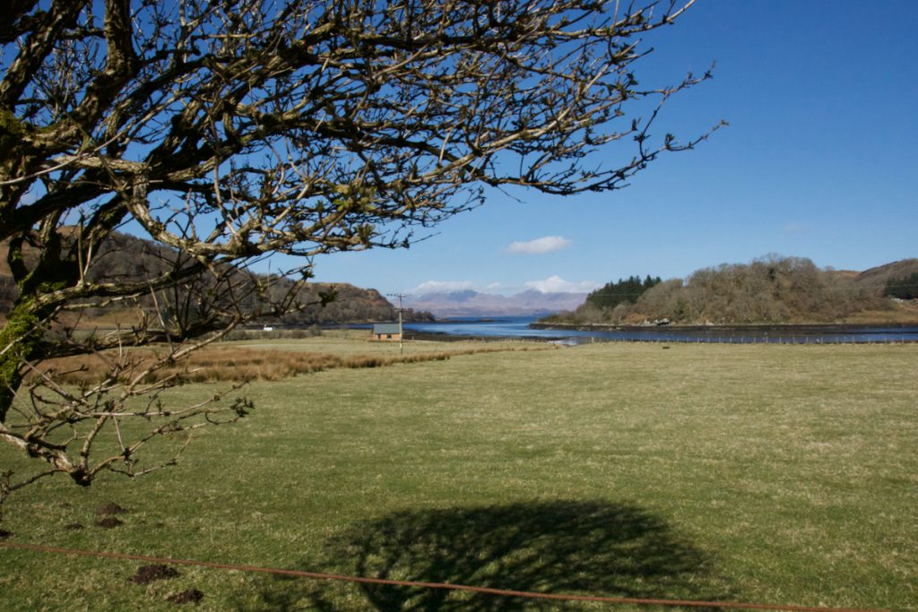
We waited for a low tide, and then walked down to the shore from the roadside, picking our way carefully over barnacle-covered rocks and stepping across a burn that was bubbling out to sea. It was a clear, crisp morning and in places the seaweed was still crunchy with frost. Lovely things caught our eye – the texture of driftwood, pearlescent mussel shells, pussy willows.
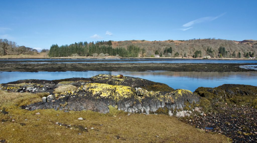
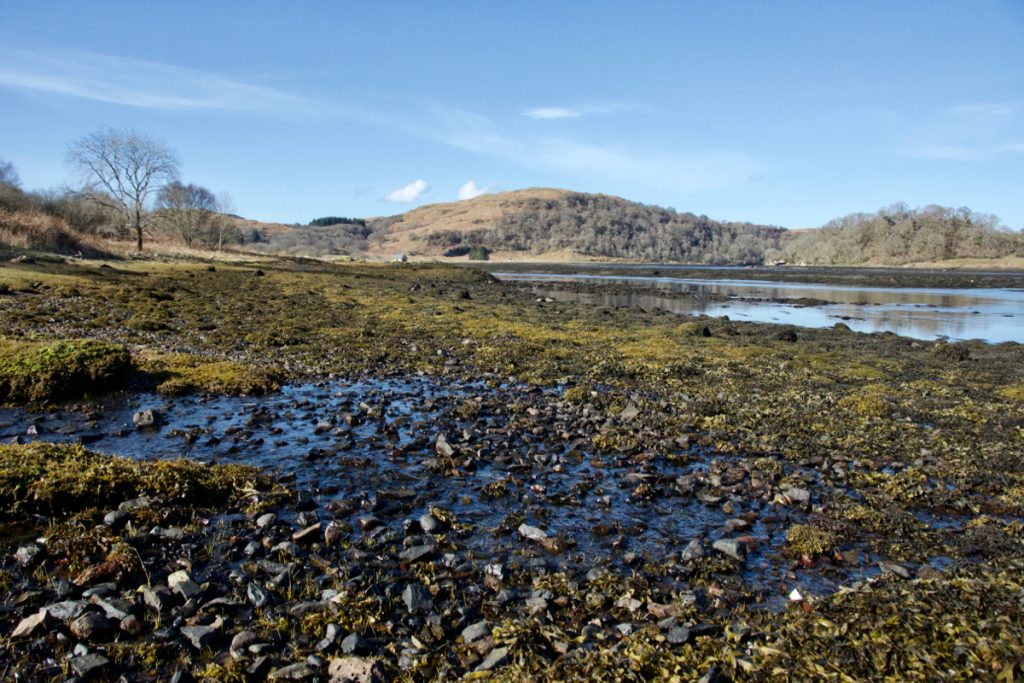 Where was Carraig nam Marbh? An obvious candidate was a flat-topped lump of black basalt projecting out into the water, its surface pitted with shallow rock pools which contained thousands of broken shells. It is probably washed, but not completely covered, at high tide, and its relative prominence gives it a sweeping view up and down the loch. According to the map, the small tidal island nearby is called ‘Carn Alpein’ which has a fascinating echo in ‘Ailpein’ and ‘MacAlpin’, the family name of early kings.
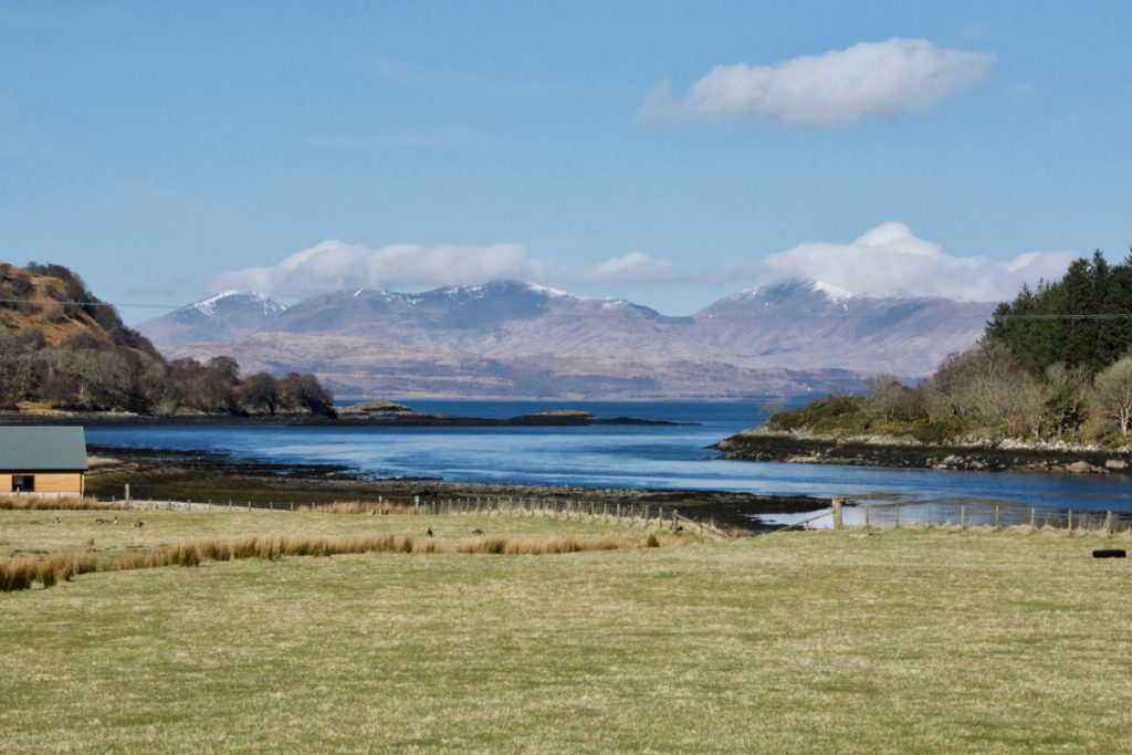
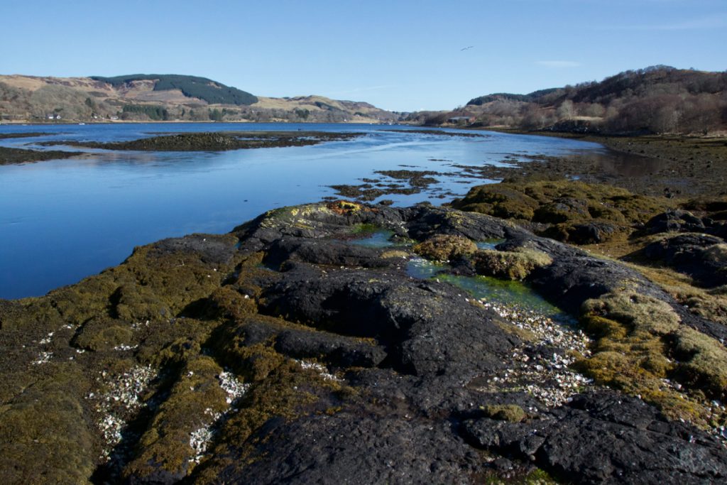 I don’t know for sure whether the exact rock we stood on is Carraig nam Marbh, but what I do know is that the view across to Mull is mesmerising. As the galley pulled away from the shore, it would have turned slowly north-west around Ardentallen Point, the tip of the peninsula suddenly giving way to a wide expanse of sea with mountains beyond – veiled in cloud, perhaps, or white with snow, or gilded with morning sunlight. Across the Firth of Lorn, you can imagine the rhythmic dipping of oars and the sails slowly filling with wind.
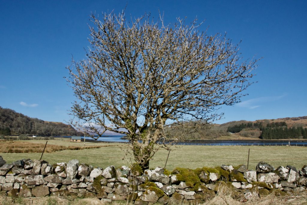
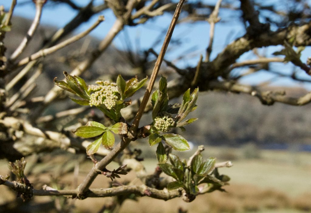
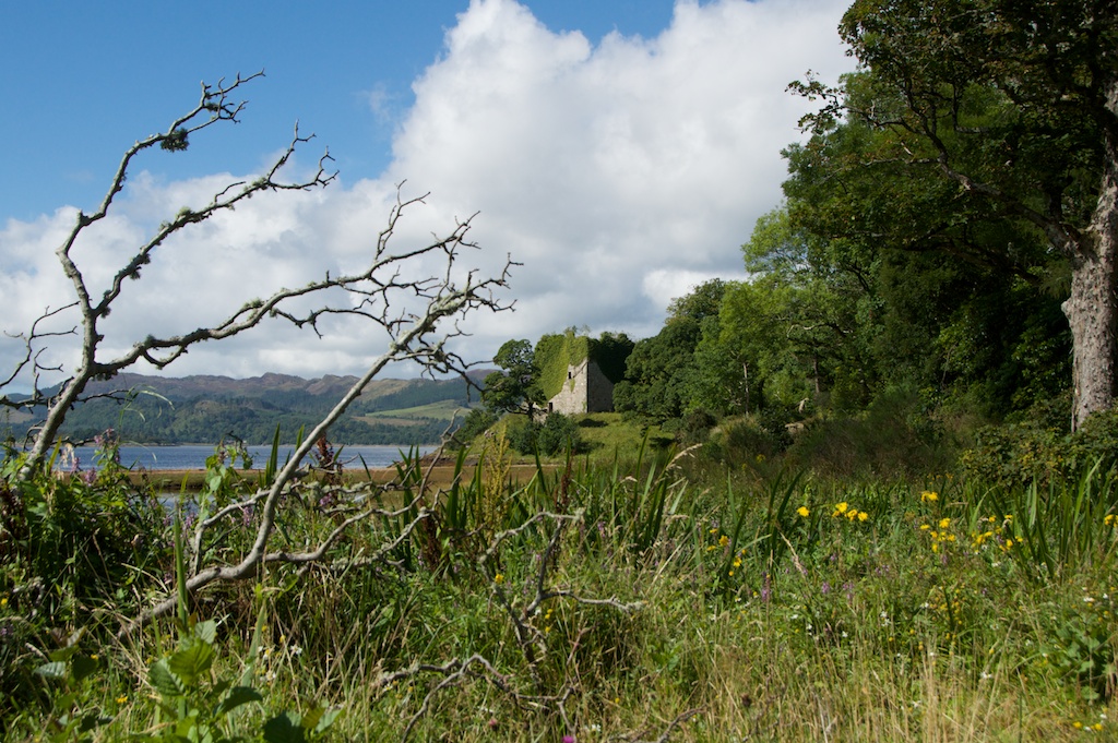
 About a hundred yards away, as I stopped to photograph the view out to Mull, I found myself automatically framing the photo to include a roadside tree. Then I noticed the tree itself. It was an elder. Another elder! I remembered the one that puzzled me at Temple Wood, and had to laugh at myself. The ‘mother goddess’ tree, associated with death and regeneration, deep Earth wisdom, and protection against evil. It was growing beside a moss-covered wall, its flowers still tightly in bud, leaves just starting to emerge. Spirit of place? How could anything else be growing in this spot!
Photos copyright © Jo Woolf
Sources and further reading:
- ‘Journeying in MacDougall Country‘ by Walter MacDougall, a delightful and evocative account of a journey around ancestral homelands in Argyll. This is where I first read about the Road of the Kings.
- RCAHMS Canmore
- Forteviot’s royal palace, where Kenneth I is said to have died, is discussed in Current Archaeology
- St Oran’s Chapel and burial ground on Iona: RCAHMS Canmore
25 Comments
montucky
That tree is a message in itself.
Jo Woolf
Yes! I love the idea of trees being a message.
Pat
This is a wonderful start to my day! I love how you weave the history into the place. And marvelous to find an elder. It fits in so well.
Jo Woolf
So glad to hear that, Pat! Thank you. Yes, the elder was just a photogenic tree until I looked properly at it! I was almost touching it before I realised. I’m wondering where else I’ll find them!
dairiel
Thank you very much for this one (although I enjoy all of your posts). I have been on a boat in the Firth of Lorn and remember scouring the Mull side with my binoculars trying to think where there landing point might be for those boats with the dead, heading for Iona. That you’ve posted about the other side is just perfect. Lots more to investigate. Those old routes are very special. Have you seen them (i’m also thinking of pilgrim routes from, say, central Scotland, or even Lindisfarne) reliably documented? Will check your Road of the Kings tag. Thank you again.
Jo Woolf
Thank you, and that’s very interesting! Did you come to any conclusions? There is so little to go on, and my own suggestion after Glen Lonan (from Loch Nell to Kilmore) is really just speculation. As for the first part of the route, if the procession started in Perthshire, I can again only guess. Perhaps along Loch Earn, through St Fillans, and then down Strath Fillan which has many very ancient sites. It’s such an obscure and quite specific question. I might make a few enquiries and see what I can find out. I don’t know why, but it really captivates me.
dairiel
Yes, like you say: St Fillans etc. and before that maybe back through Comrie, and Fowlis Wester (with it’s long history) and Crieff, etc…. The old drove roads perhaps could have played a part, but it was so long ago. It captivates me too and not sure why, but it’s very insistent at times. After reading your post, I was again thinking about where on Mull would they land with this sacred cargo? Look at the map, I wondered about Loch Spelve which is more or less straight across the Firth of Lorn and then found this: http://www.mull-historical-society.co.uk/churches/churches-2/killean/ . It made me wonder….. Will keep looking. Thanks again, David
Jo Woolf
Oh yes, I remember seeing that when we drove down Loch Spelve – or rather, I remember looking it up afterwards and wishing I’d stopped to take a closer look! On a pilgrim route, as you say, so quite likely. I love the story of the bone in the church wall! Thank you very much for sharing your thoughts – it’s really nice to know you were pondering it too! I’m going to see what else I can find. May take a while but there’s no rush. Meanwhile I’ll gaze at Carraig nam Marbh every time I go to Oban! Don’t think it’s going to go away!
Jo Woolf
Hello again, I’ve just stumbled across this on Twitter, and looked up their website. ‘Locating Lorne’ – a project to walk from Schiehallion to Iona, and as you’ll see they are following the Road of the Kings – and it gives details of their route. Only just looking at it myself, but delighted to have found it! http://www.locatinglorne.net/story/worldsend/
dairiel
Dear Jo, well that’s an interesting number of connections to a central theme. The Yew, Ogham, the Road of Kings, Fortingall (of course), etc to Loch Spelve, then on to Dun-I and the Well of Age on Iona and more. Have to say Thank you so much for sharing. Lots to research and good on those folks for following their inner call to the Path across the land (with hints from ‘Findo Gask’). Will just say none of that sounds unfamiliar, and the inclusion of Schiehallion is just right to my feeling. Will have to keep an eye on their progress, given that it’s just past full moon now. Have a sense there more to come here. Thank you again.
Jo Woolf
Yes, very true! And I love the idea of taking some of the water from Schiehallion well, and some seeds from the Fortingall Yew. Lots to go on now, as you say! I might contact the pilgrim walks website.
Sandra
Such an atmosphere in this post! And such a stunning spot!
Jo Woolf
Thank you, Sandra! I’m really glad you enjoyed it. Yes, what an amazing spot! And Glen Lonan has a special atmosphere as well. Like so many places around here, you feel as if the ‘past’ is not really ‘past’ at all, just out of sight somewhere.
Deb Vallance
Mesmerizing, both prose and pictures–thank you!
Jo Woolf
You’re most welcome, Deb! Glad you found it absorbing. I get carried away sometimes! Easy to do, in this place!
davidoakesimages
Well that is something else to add to the list….. years ago visited the Standing Stones at Glenamachhrie (not that I recall much about them now) and promised myself that I would explore the Glen. Thanks again for another informative feature
Jo Woolf
Welcome, David! Glad you enjoyed it. There is a story attached to every stone and every hilltop, or so it seems!
davidoakesimages
The next book then?
Jo Woolf
Haha, or several!
davidoakesimages
That’s Fine….I’ll just settle for 10% royalties
Jo Woolf
Lorna
Your photographs are beautiful and what cracking weather. The scenery looks rather magical.
Jo Woolf
Thank you, Lorna! It was a particularly lovely morning and we made the most of it. I love the sea lochs south of Oban – so peaceful!
F.Yeoman.
Port nam Marbh. Is the place where the dead were landed on Mull, after being ferried from
Carraig nam Marbh in Loch Feochan. If looking at map of the sound of Mull, the port is a small shingle inlet about a mile north of Radha na Faoilinn at the entrance of Loch Spelvie, Towards Oban, on the sound of Mull, Marked on older 6ins maps.
With unpredictable weather it probably better to sail straight over.
Rather than risk some notable getting a sea burial.
Jo Woolf
Thank you for that! I’ll look on the map!