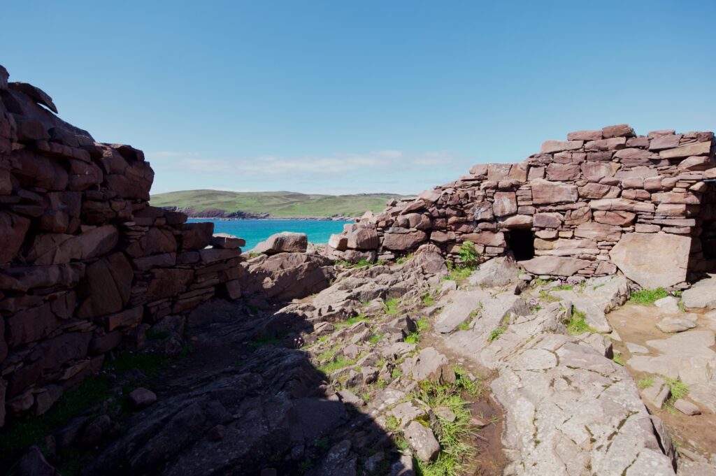
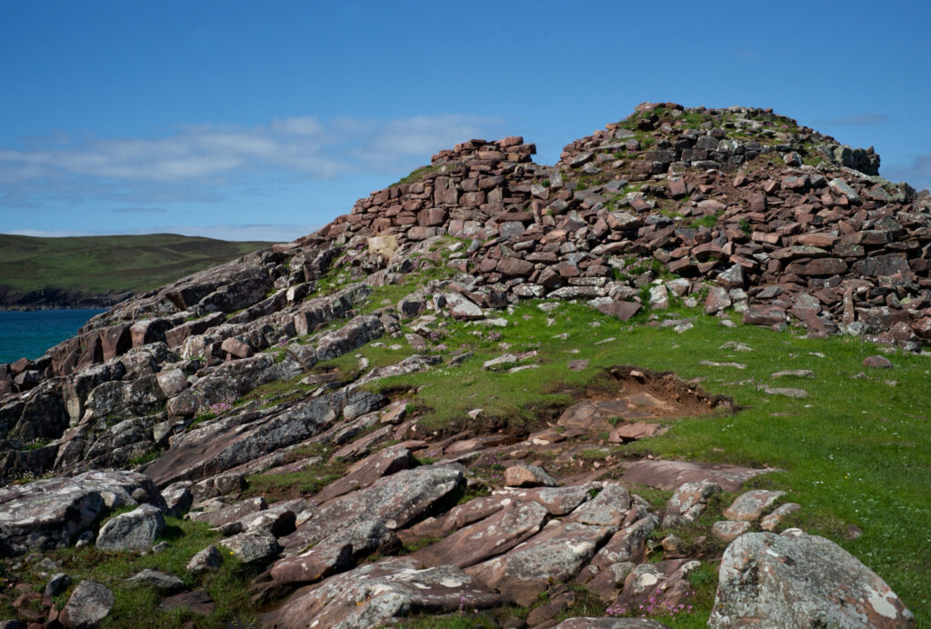
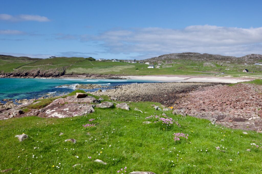
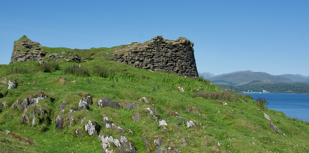
The remains of an Iron Age broch sit on a low headland between the Bay of Clachtoll and the Bay of Stoer near Lochinver in Sutherland. This is a ragged peninsula that stretches for about 12 or 15 miles west of the dark towering bulk of Quinag in a fretwork of moors and lochans, falling to rocky windblown shores with startling white-sand beaches and damp, tangled woods of hazel, oak and aspen.
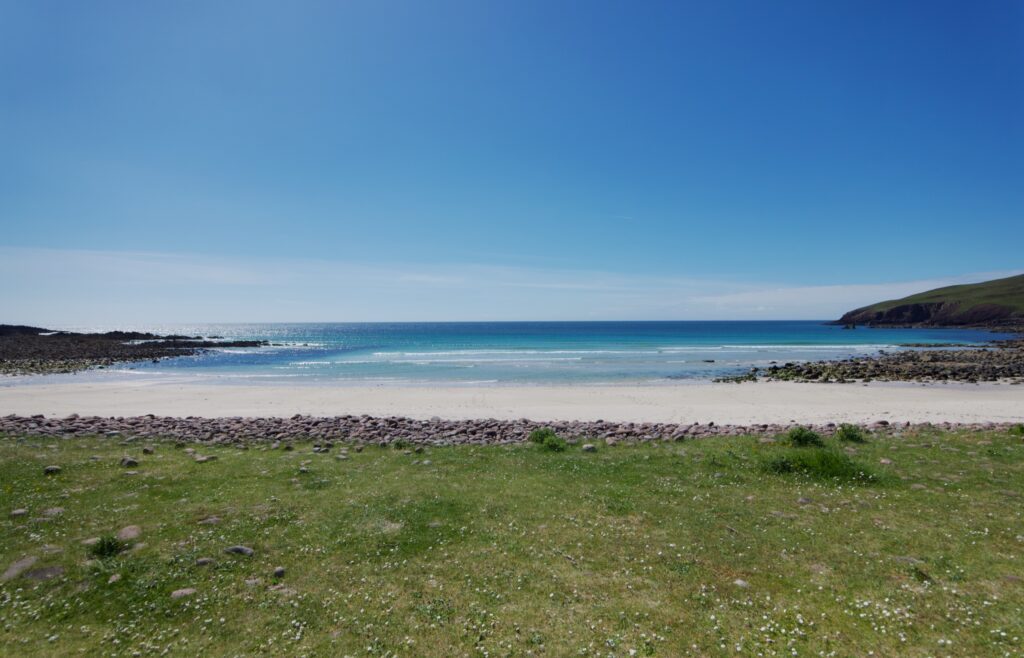
It was a brilliantly sunny afternoon when we went there, and as we walked across the beach it was hard to take my eyes off the turquoise sea. (It looked almost tropical… but don’t be fooled by the colour. When I gave in to temptation a couple of days later, and went for a swim at Oldshoremore, it was absolutely freezing and I was out again within a minute.)
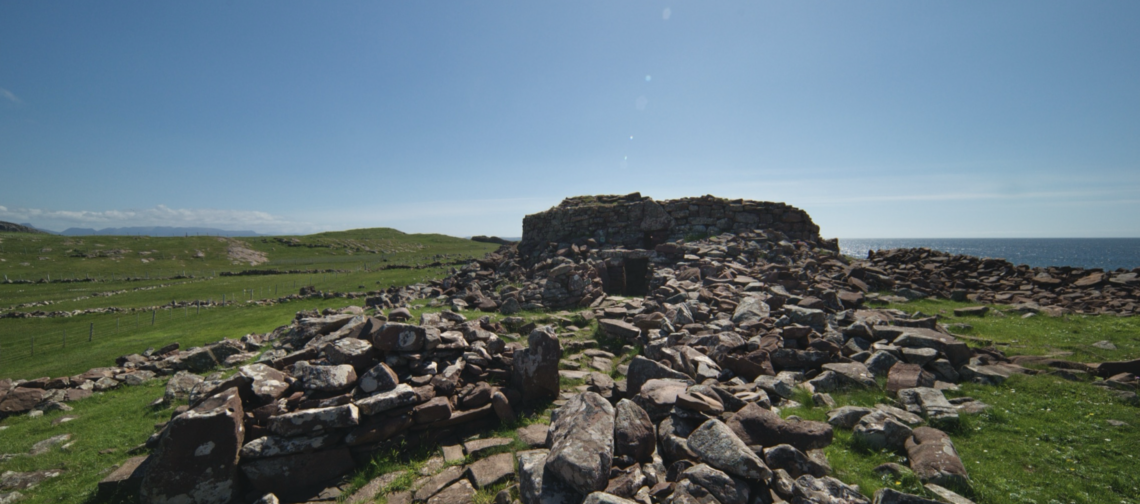
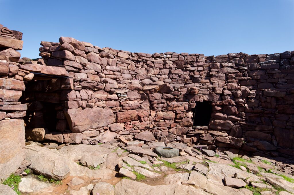
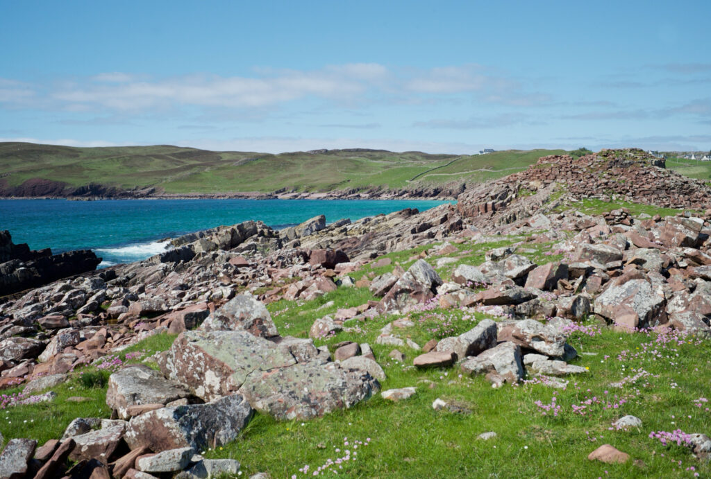
At first, the structure is hard to distinguish from the tumble of reddish-brown boulders that litter the shore, and it’s likely that some, at least, of this material originally made up the walls of the broch and nearby buildings.
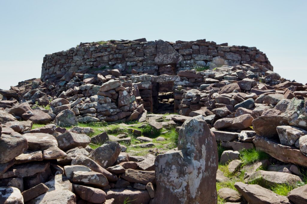
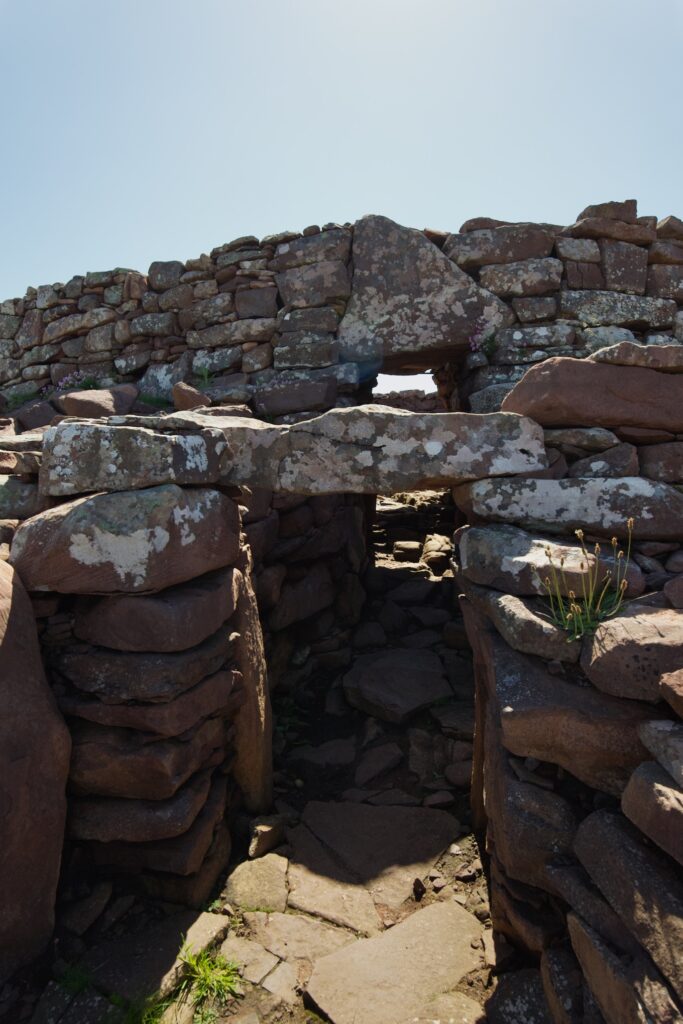
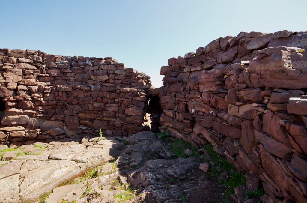
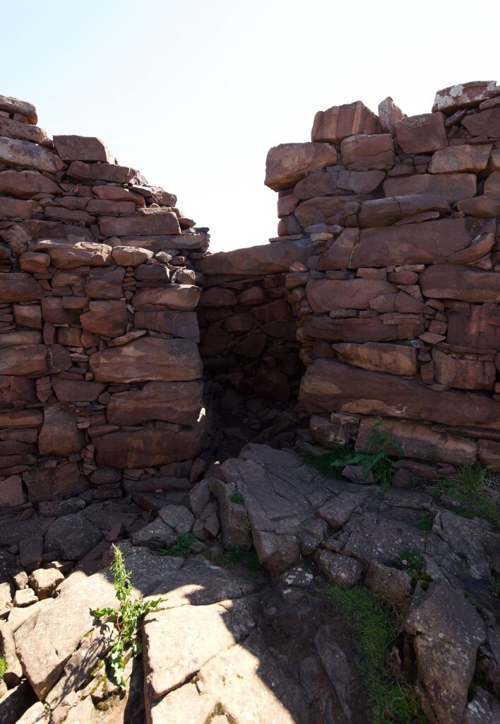
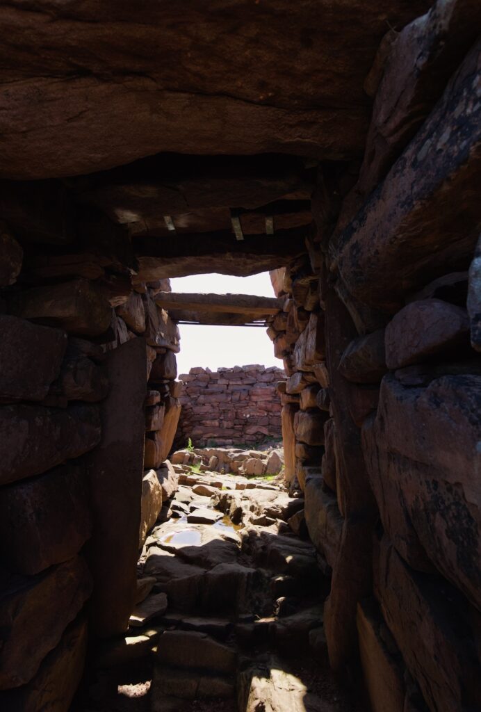
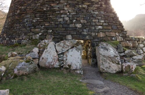
A path leads around the foreshore to the broch, and as you get closer you can make out the curving shape of the surviving walls and an entrance, still quite impressive. There are two big lintels to duck under: the first is a remnant from some kind of outbuilding, and the second, a big triangular stone, supports the outer wall of the broch itself.
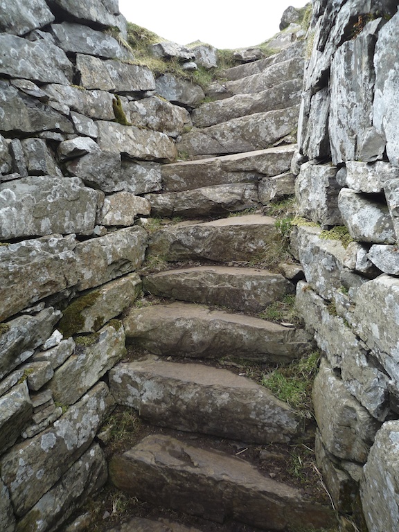
Through the passageway built into the 13-foot-thick walls and you’re inside the circular chamber, with the pink flowers of thrift pushing up between the uneven rocks that line the floor. Good sections of stonework rise to nine or ten feet in places, but two thousand years’ worth of storms and high tides have caused it to tumble away on the sea-facing side.
The broch’s builders dug into the bedrock in an effort to make it level, and used the rocks that they’d quarried to build the walls. When it was occupied, the floor was carpeted with a layer of rushes and grasses.
Brochs
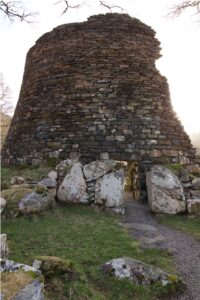
Dun Telve, Glenelg
Unique to Scotland, brochs are thickly scattered across the north of the mainland, as well as the Northern and Western Isles, with a handful also in Argyll, the Central Belt and the Borders. Most date from the first centuries BC and AD. Circular in plan, their twin-walled construction allowed space for small chambers and stairs within the walls; they had one low doorway, and no windows. What kind of roof they had is still a matter of debate, because none has survived. They could have been turfed or thatched with reeds, bracken and heather.
As for their purpose, while they were once thought to have been defensive structures, it is now believed that their function was more domestic, providing a home for several generations of families.
Brochs had a distinctive ‘cooling tower’ profile, and they were tall: Mousa Broch in Shetland, for example, still stands at over 42 feet (13 metres) high. But the artist’s impression of Clachtoll broch shows it to be quite a squat-looking structure, with a conical roof sitting on walls that don’t look more than twice their present height. From studying clues in the stonework, archaeologists believe that Clachtoll broch has been re-modelled on several occasions, starting out much taller but then being partly re-built with a lower profile, perhaps out of necessity when an earlier version collapsed.
Enlargement from an illustration on the information board at the site, showing how the broch might have looked. Artwork by Chris Mitchell
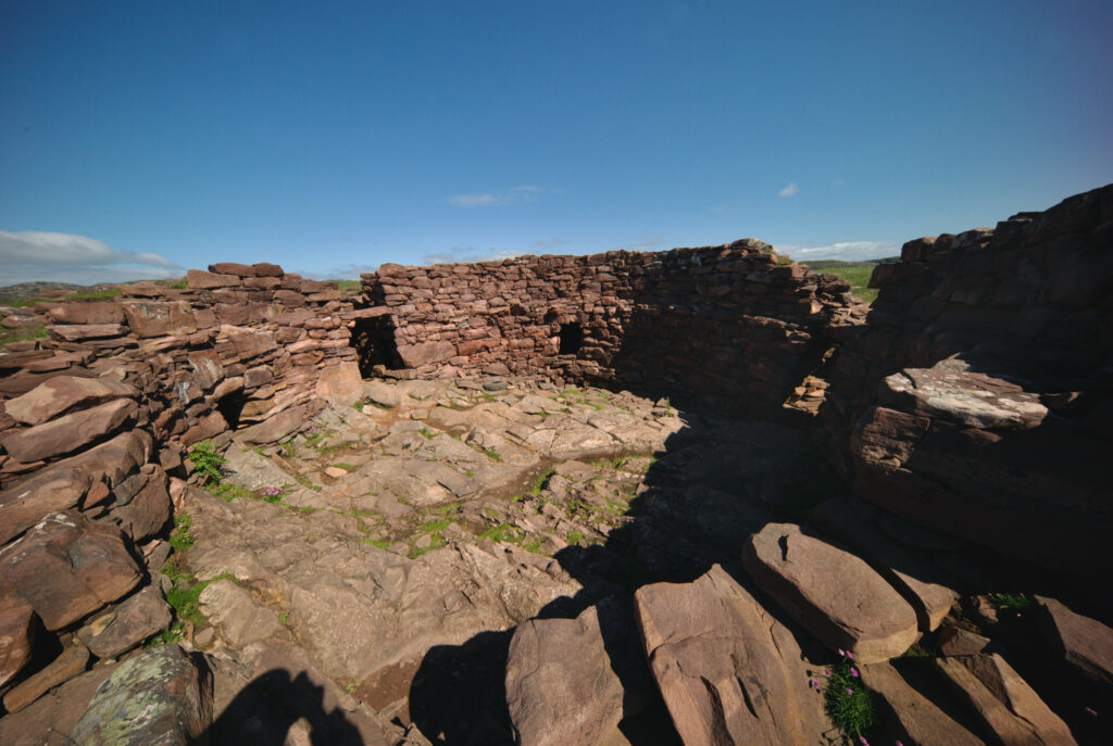
Small squarish gaps in the wall lead to cells in the cavity between the double-thickness walls; at Clachtoll, one was used for storing grain and another appears to have been a midden, but the purpose of a third is still unclear. A scarcement ledge or projecting shelf supported wicker platforms for living space above ground floor level. This is visible as a row of slightly projecting stones about halfway up the surviving wall.
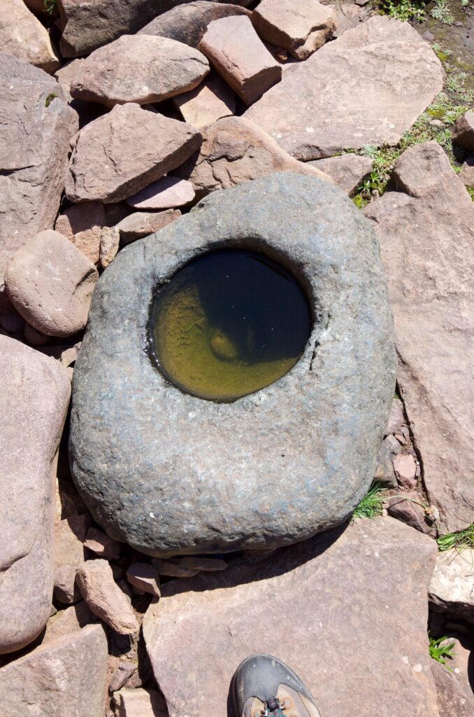
While Clachtoll isn’t on the same scale as other brochs I’ve seen, such as Dun Carloway and the brochs of Glenelg, the site itself has a special interest because archaeologists have discovered that a disastrous fire early in the first century AD brought its occupation to an abrupt end. Whether or not this fire was an accident or an act of aggression, it is impossible to say. However, the building was abandoned hurriedly and never re-occupied, leaving a thick layer of ash and carbonised wood to preserve artefacts that would normally decay or disintegrate: iron sickles and scythes leaning against the walls, sheaves of barley in the storerooms, and barley grains in the cup-shaped hollow of a ‘knocking stone’, perhaps in the process of being pounded with a mortar.
Wind-blown sand had covered the burnt layer before the stones fell on top of it, suggesting that the higher stonework might have stood for a while after the fire and then collapsed.
A ‘knocking stone’ found inside the broch was full of barley grains that had been carbonised by the fire
Among other items found were about 250 sherds of pottery, some decorated with incised and impressed patterns, and some even bearing the fingerprints of the maker; an unfinished bowl made of alder wood; a short length of wool, made from four twisted strands of spun fleece; four long-handled combs, thought to have been used in weaving or working with wool; bone needles and pins; a handful of spindle whorls; a whalebone anvil, pitted with the marks of tools; pieces of deer antler, ready to be worked; and the pommel of a dagger made of marine ivory (possibly a whale’s tooth) which has been finely ornamented.
With no windows, the people inside the broch needed light to work by. The fire threw out light as well as warmth, but they also had a number of stone bowls that were once filled with lighted fat to serve as lamps. Likewise, short slivers of Scots pine with burnt tips might have been used as candles.
From the food remains uncovered in the stores and the midden, it was evident that barley was being grown nearby. Cattle and sheep were being kept for their meat as well as their milk and fleeces; fish were being caught, and likely suspended over the central fire to be smoked. Puffin and guillemot bones were also found, and the shells of limpets and periwinkles that had been gathered from the shore.
Above and below: the broch from the south, showing its proximity to the sea
Trees such as birch, hazel and Scots pine would have been more widespread during the Iron Age, and it sounds from the archaeological finds as if alder was also available, growing in the wetter places. The positioning of the broch might have been influenced by the proximity of workable, fertile soil:
‘Iron Age settlements tend to cluster around the better soils, like the machair of Clachtoll and Stoer bays. There are areas to the north of the broch that might have been candidates for the cultivation of barley… the land to the east and south-east of the broch may have been boggy or even entirely underwater.’
Clachtoll Broch, Historic Assynt
Features in the main floor space include a hearth that was placed slightly off-centre, and stones arranged to form a possible water container. Similar containers in other brochs were lined with clay, but no evidence of clay was found here; archaeologists have speculated that it might have been lined with animal hides. Inside the container were found traces of fire-cracked stone, animal bone and shell, suggesting that it was used for heating and cooking food.
At the beginning of this century, Clachtoll broch was in imminent danger of further collapse. Rising sea levels were bringing the highest storm waves just within range of the soil underlying the foundations on the sea-facing side. In addition, the broch’s interior was choked with rubble from the fallen walls.
After public consultations, a community heritage group called Historic Assynt coordinated efforts to save the structure. Historic Environment Scotland commissioned a conservation management plan, and in 2017 a programme of repair, consolidation and excavation was undertaken by AOC Archaeology Group.
Looking out through the entrance passage, with the underpinning of lintels visible
‘The broch is now in a stable condition, and continues to endure being buffeted by Assynt’s harsh weather and crashing waves.’
Clachtoll Broch, Historic Assynt
While Clachtoll was being excavated, the project team investigated three nearby forts and duns of similar age. Radiocarbon dating from these sites returned dates that were contemporary with the final occupation of Clachtoll broch. Historic Assynt’s booklet explains that ‘…the known settlement sequence from the Stoer area seems to come to an end in the early years of the first millennium AD, around the time of the broch’s demise.’
Why was that? It’s interesting to wonder. Archaeologists have speculated that Clachtoll may have contained the surplus grain harvest for these smaller, ‘satellite’ sites, and therefore when these stores were lost in the fire, both Clachtoll’s occupants and the wider community were forced to move on. But equally, some other factor that we can’t detect might have driven them away. They took their story with them, and I would love to know what it was.
Looking north across Stoer Bay
The broch on an 18th century map
‘A Plan of the Farms of Storie [Stoer], Clachtoll, and Auchmelvich [Achmelvich]’ from John Home’s Survey of Assynt, 1774. Clachtoll Broch is marked as ‘Old Castle’. To the south and east of the broch are ‘Corn Lands’ and an area marked ‘Flat green sandy ground called the Links’, which have marks indicating cultivation. Houses or dwellings are shown close by. These areas, and others further afield, were likely productive for the broch’s inhabitants two thousand years earlier. What happened to the people who farmed this land in the 18th century? Were they also dispersed, perhaps to start new lives on another continent? Map via National Library of Scotlandmaps.nls.uk
–
Reference
Historic Assynt, Clachtoll Broch: An Iron Age Home in Assynt – publication (2022) and online
Absolutely fascinating Jo.I do wonder why they built the brocks so close to the sea where they are so vulnerable to storms and high tides.Was there a defensive element in their choice of location and maybe the fire was caused by a rival tribe?I am always impressed by their skill in constructing these building with just pure man power.
Richard Miles
Thank you very much, Richard. I wondered the same thing myself, but I can’t find any mention of a possible reason for building so close to the sea, except that there was fertile ground close by. And of course a ready supply of stones! They were definitely skilled builders – although the stonework at Clachtoll has suffered quite a bit, the better-surviving brochs at Glenelg are very impressive. I think that archaeologists simply can’t tell if the fire was caused by an attack from outside. It’s a scenario that’s quite easy to imagine, however.
I would imagine (but don’t know for sure) that it’s perhaps indicative of the builders’ primary mode of transport being by sea rather than land, or at least being an important element.
While brochs are unique to Scotland, I’m just back from Sardinia where they have an older type of building called a nuraghe. The similarities are striking.
That’s very true about sea travel, and maybe also the sea offered a quick escape in an emergency. I wonder if any evidence of boat-building has ever been found at any sites. I’ve visited quite a few brochs but none of them is as close to the water as this one – you could almost imagine it having its own slipway. Very interesting to hear about Sardinia’s nuraghe buildings. I’ve just been reading about them. They do look very similar, from the pictures I’ve seen.
Is Clachtoll Broch also known as An Dun Broch that is marked on the OS. Quite a few years ago we searched for it but eventually gave up.
Another good read, thanks. I also admit I havent got to the end yet 🙂
Thank you, David. That’s a shame that you couldn’t find it. On our OS Landranger map it’s marked as ‘Broch’ but it’s possible that older versions might have shown it as ‘An Dun Broch’. It’s confusing because although it’s known as Clachtoll Broch it’s actually closer to the beach at Stoer, and it’s hard to make out from the road.
Great blog, Jo. Most comprehensive description of what a brochure actually is that I’ve ever read. Totally coincidentally, AOC arch was founded by my old friend and fellow UC Cork graduate, John Barber.
Thank you Finola, that’s really nice to know! What a coincidence that AOC was founded by your friend John Barber. He led the team that excavated the broch. It sounds like a fascinating project to have worked on.
Thank you, Simon! It’s definitely worth taking a walk along the beach to Clachtoll broch. We absolutely loved our time up there and hope to go back soon.
Oddly enough Jo a couple of weeks ago I had seen a Youtube video on that broch and the great rescue work done by the local History Group.
It was the first time I’d heard of all the artifacts they found and incredibly, in that salty air the iron sickles which had survived for millennia.
That’s a coincidence, Bob! I first heard about it earlier this year when I saw a documentary on History Hit, which might be the same one that you saw. You’re right that it’s amazing how those sickles have survived, and the hank of wool for that matter. Huge credit to the archaeology team and Historic Assynt for excavating and preserving the structure.


14 Comments
Richard Miles
Absolutely fascinating Jo.I do wonder why they built the brocks so close to the sea where they are so vulnerable to storms and high tides.Was there a defensive element in their choice of location and maybe the fire was caused by a rival tribe?I am always impressed by their skill in constructing these building with just pure man power.
Richard Miles
Jo Woolf
Thank you very much, Richard. I wondered the same thing myself, but I can’t find any mention of a possible reason for building so close to the sea, except that there was fertile ground close by. And of course a ready supply of stones! They were definitely skilled builders – although the stonework at Clachtoll has suffered quite a bit, the better-surviving brochs at Glenelg are very impressive. I think that archaeologists simply can’t tell if the fire was caused by an attack from outside. It’s a scenario that’s quite easy to imagine, however.
Stravaiging around Scotland
I would imagine (but don’t know for sure) that it’s perhaps indicative of the builders’ primary mode of transport being by sea rather than land, or at least being an important element.
While brochs are unique to Scotland, I’m just back from Sardinia where they have an older type of building called a nuraghe. The similarities are striking.
Jo Woolf
That’s very true about sea travel, and maybe also the sea offered a quick escape in an emergency. I wonder if any evidence of boat-building has ever been found at any sites. I’ve visited quite a few brochs but none of them is as close to the water as this one – you could almost imagine it having its own slipway. Very interesting to hear about Sardinia’s nuraghe buildings. I’ve just been reading about them. They do look very similar, from the pictures I’ve seen.
davidoakesimages
Is Clachtoll Broch also known as An Dun Broch that is marked on the OS. Quite a few years ago we searched for it but eventually gave up.
Another good read, thanks. I also admit I havent got to the end yet 🙂
Jo Woolf
Thank you, David. That’s a shame that you couldn’t find it. On our OS Landranger map it’s marked as ‘Broch’ but it’s possible that older versions might have shown it as ‘An Dun Broch’. It’s confusing because although it’s known as Clachtoll Broch it’s actually closer to the beach at Stoer, and it’s hard to make out from the road.
Finola Finlay
Great blog, Jo. Most comprehensive description of what a brochure actually is that I’ve ever read. Totally coincidentally, AOC arch was founded by my old friend and fellow UC Cork graduate, John Barber.
Jo Woolf
Thank you Finola, that’s really nice to know! What a coincidence that AOC was founded by your friend John Barber. He led the team that excavated the broch. It sounds like a fascinating project to have worked on.
davidoakesimages
Thats the one… its was nearer to Stoer…i know we had what seemed like long trek but may be that was because we walked in too many circles 🤣🤣
Jo Woolf
Oh no! 😂 I know what that feels like. It sounds as if you were very close, though, which is even more frustrating!
Simon
as ever great article – I love that area and visited several times – will look out for this next time
Simon
Jo Woolf
Thank you, Simon! It’s definitely worth taking a walk along the beach to Clachtoll broch. We absolutely loved our time up there and hope to go back soon.
Bob Hay.
Oddly enough Jo a couple of weeks ago I had seen a Youtube video on that broch and the great rescue work done by the local History Group.
It was the first time I’d heard of all the artifacts they found and incredibly, in that salty air the iron sickles which had survived for millennia.
Jo Woolf
That’s a coincidence, Bob! I first heard about it earlier this year when I saw a documentary on History Hit, which might be the same one that you saw. You’re right that it’s amazing how those sickles have survived, and the hank of wool for that matter. Huge credit to the archaeology team and Historic Assynt for excavating and preserving the structure.