Arran: the stones and cairns of Machrie Moor
Casting about for ideas for a day trip, I was looking at the map of Kintyre and in particular the lonely Calmac terminal at Claonaig, near Skipness, where there’s a regular ferry to Arran. This, in effect, is the back door to the island because the main service, on a bigger vessel, departs from Ardrossan in Ayrshire and sails to Brodick on the east coast. But Claonaig is much more accessible for us, lying only about 20 miles south of Lochgilphead. The little ferry sails across the Kilbrannan Sound to Lochranza, and even in winter the timetable leaves you enough time for a bit of exploration before you need to head back.
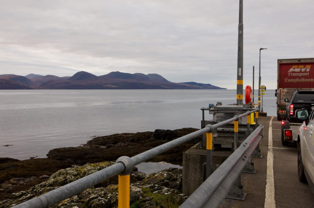
Although you can buy tickets in advance if you wish, it’s not possible to book a specific sailing. This is one of Calmac’s less-frequented routes, which still operates on a turn-up-and-go basis. We arrived well in time for the first ferry on a calm and overcast morning, and spent a relaxing half hour or so watching great northern divers and small groups of eiders out on the water. Along with a handful of other cars and a lorry we were loaded promptly, whisked across the steel-grey water and released into the wild thirty minutes later at Lochranza.
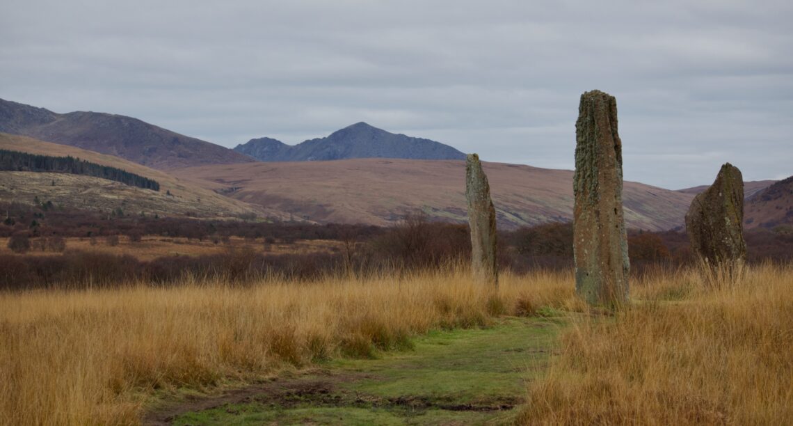
Our first and main destination is one of Arran’s finest attractions, and one that I’ve long wanted to visit: the standing stones at Machrie Moor. I’d read that they were among the tallest stones in mainland Scotland and I’d seen photos of an impressive example, hewn out of sandstone and curiously fluted at the top like a crinkle-cut crisp. But I wasn’t prepared for the abundance of megalithic sites here – so many, in fact, that your mind struggles to keep track of stone circles as you encounter one after another in rapid succession.
Machrie Moor is a low-lying expanse of moorland on the west side of Arran, only a mile or so from the coast. Flowing down from the north, the Machrie Water cuts a meandering path through the middle and then tumbles noisily through a wooded ravine. On its landward fringes, the moor is rimmed by birch woodland that gives way to low hills; to the north-east rise the higher, darker shapes of Goat Fell and its neighbours.
Looking around, as you make your way along the path from the car park, it soon becomes clear that this is a blanket bog, overgrown with water-loving grasses, sedges, ferns and sphagnum moss. Where the vegetation has been scraped away, black peat lies beneath, spongy underfoot and oozing water. There was little wind, but you could see how south-westerly gales must whip across this landscape unimpeded, straight off the sea.
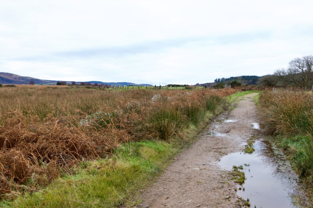
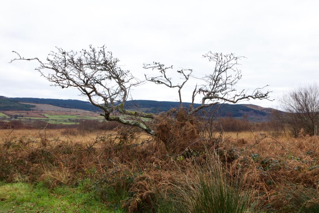
Despite its exposure, Machrie Moor seems to have attracted humans from a very early date. Beneath the peat, scientists at Edinburgh University have detected traces of charcoal from fires that were kindled nearly 9,000 years ago, during the Mesolithic period, and analysis of this charcoal shows that it was derived from the burning of reeds, rather than trees. While it’s possible that such fires were the result of lightning strikes, other possibilities were suggested, including the theory that humans were deliberately setting fire to reeds in order to flush out game and wildfowl.
However, the earliest confirmed traces of human activity on Machrie Moor date from about 5,500 years ago, during the Neolithic period, when rings of timber posts were erected; sherds of grooved pots have been found in excavated post-holes. Over the next thousand years more posts and stakes were placed in the ground, perhaps by early farmers who cleared the woodland to make space for crops and livestock, and whose ards or simple ploughs have left faint impressions on the underlying earth.
During the Bronze Age, from about 4,000 years ago, stone circles began to replace some of the rings of timber. In some cases, burials were made in the centre of these circles, and other burials were made in large chambered cairns similar to those we’ve seen elsewhere, such as in Kilmartin Glen. It’s hard to discover just how soon these burials occurred after the completion of the stone circles. Historic Environment Scotland says that the stone circles were the focus for religious and ceremonial activities for at least 1,500 years, and that inhumations and cremation burials, along with grave goods, were made ‘probably long after [the stone circles] were first built.’
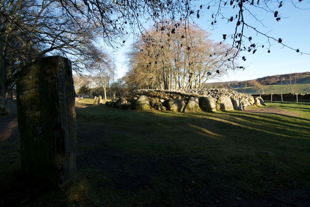
It took only 10 or 15 minutes to walk to the first site, which is called Moss Farm Road ring cairn. (Moss Farm, now in ruins, lies further along the track). Although it has been erroneously described as a stone circle, this is a Bronze Age chambered cairn, originally surrounded by a ring of upright stones that seems to have been an integral feature of its design. Of these upright stones, only seven now remain. At some time in the more recent past, a farm track passed over the cairn, and like so many other sites, it was used as a handy source of stone for building material.
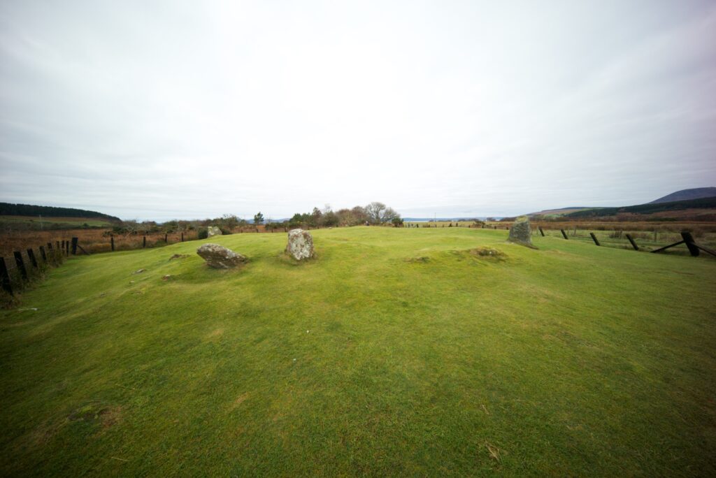
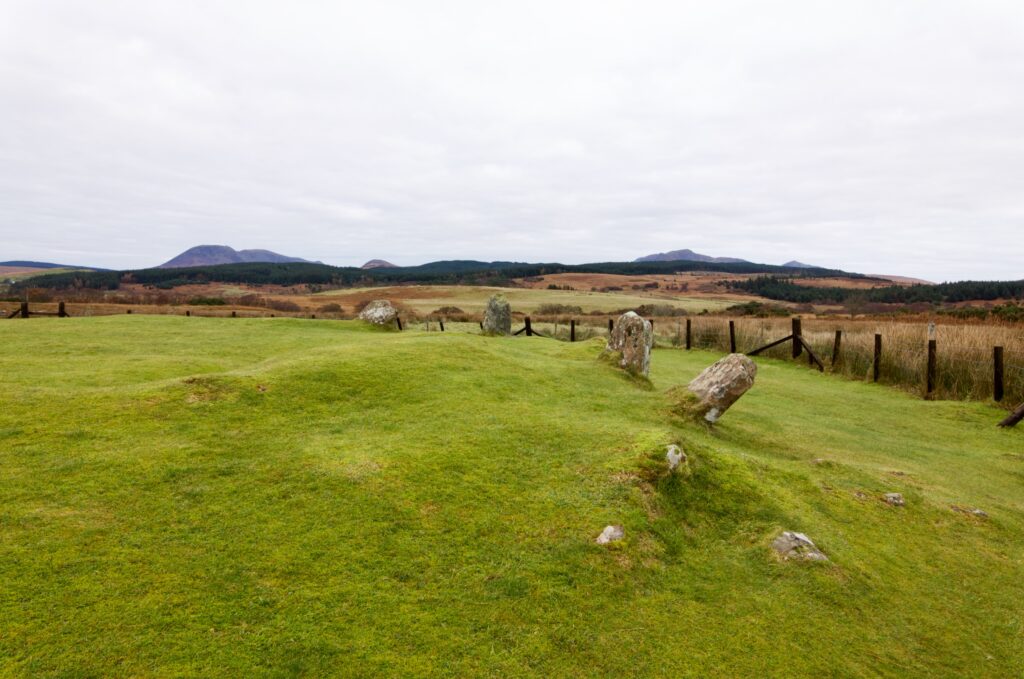
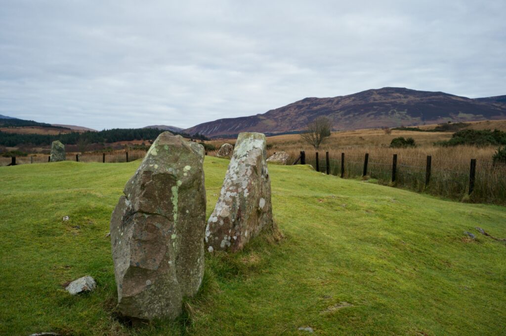
An information board illustrates the burial of a young woman in a crouched position with a decorated cup beside her, but in fact the Moss Farm Road cairn has only been partially excavated, so its contents are still unknown.
After this, more megalithic sites started appearing thick and fast…
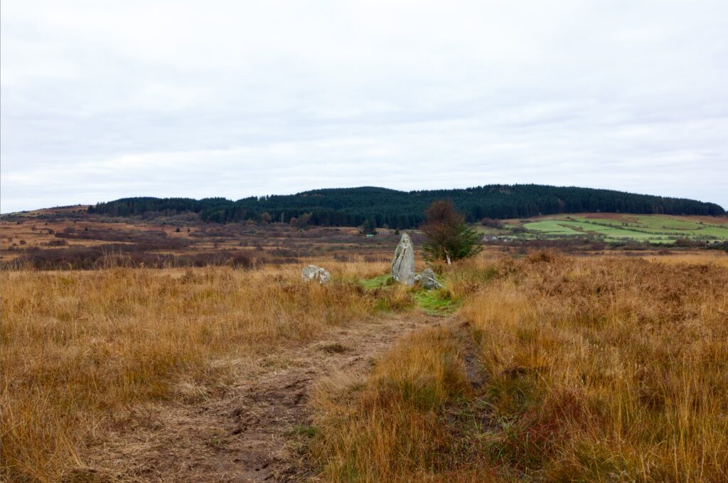
Further on, and a short distance off to the right, are the remains of another chambered cairn (above and below) with one upright stone and several others lying about haphazardly. Any covering mound has long gone.
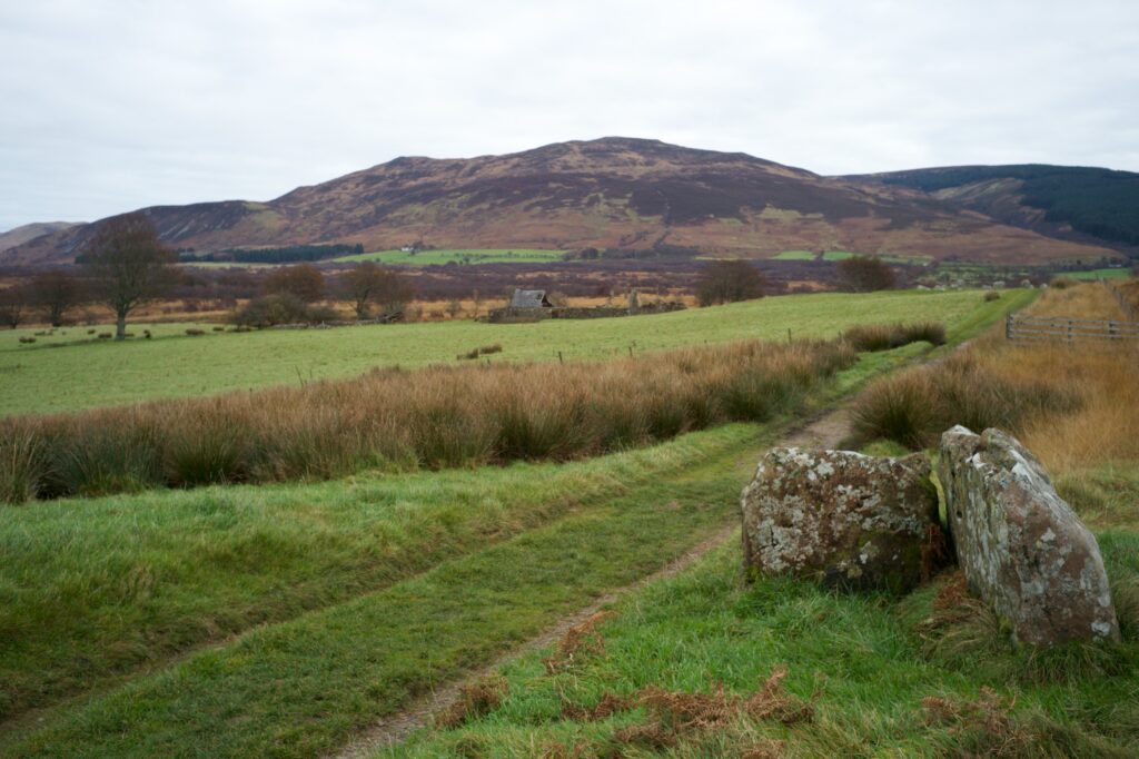
Above: sitting right beside the track, this is surely one-half of a burial cist – two large stones set at a right angle, again with no trace of covering.
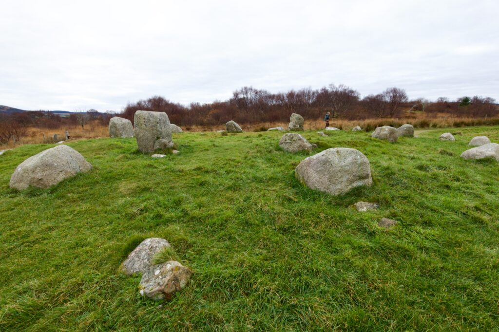
A hundred yards or so down the track we reached the first stone circle, which is known as Fingal’s Cauldron Seat (in Gaelic, Suidhe Coire Fhionn). This is the only site on Machrie Moor that comprises two concentric stone circles. It’s said that the legendary warrior, Fionn Mac Cumhaill (sometimes referred to as Fingal) lit a fire in the centre, placed his cauldron on the inner circle of stones, and sat down to wait for his dinner to cook. To stop his dog, Bran, from stealing his food, he tethered him to one of the outer stones which contains a convenient hole for a leash.
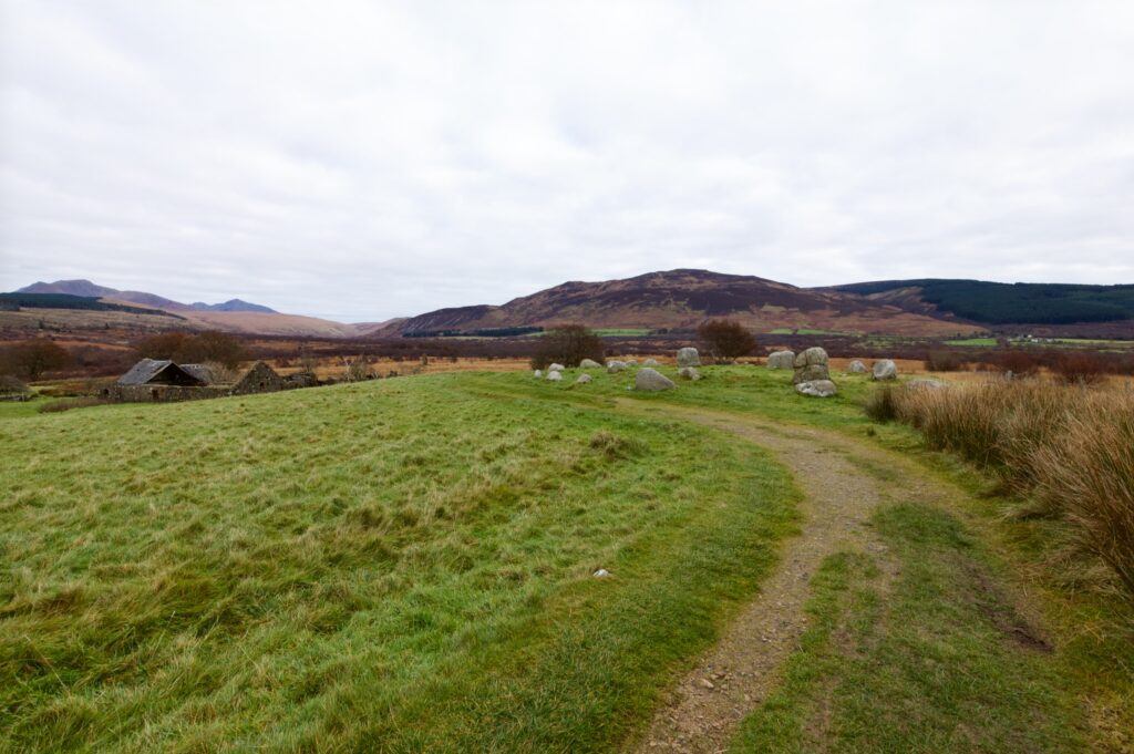
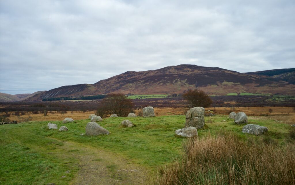
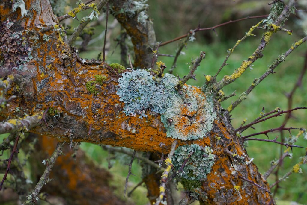
The stones here are rounded, bulky lumps of granite, the tallest no more than four feet in height; some are worn smooth and others bear a rough, dry crust of lichen. The 19th century geologist and naturalist Dr James Bryce dug here (and elsewhere on the moor) in the 1860s, and at the centre he discovered a small cist with a stone lid. Inside were some human bone fragments and black earth.
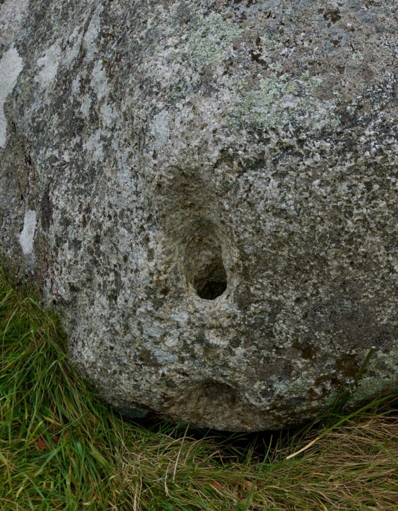
Above: the perforated stone where Bran was tethered
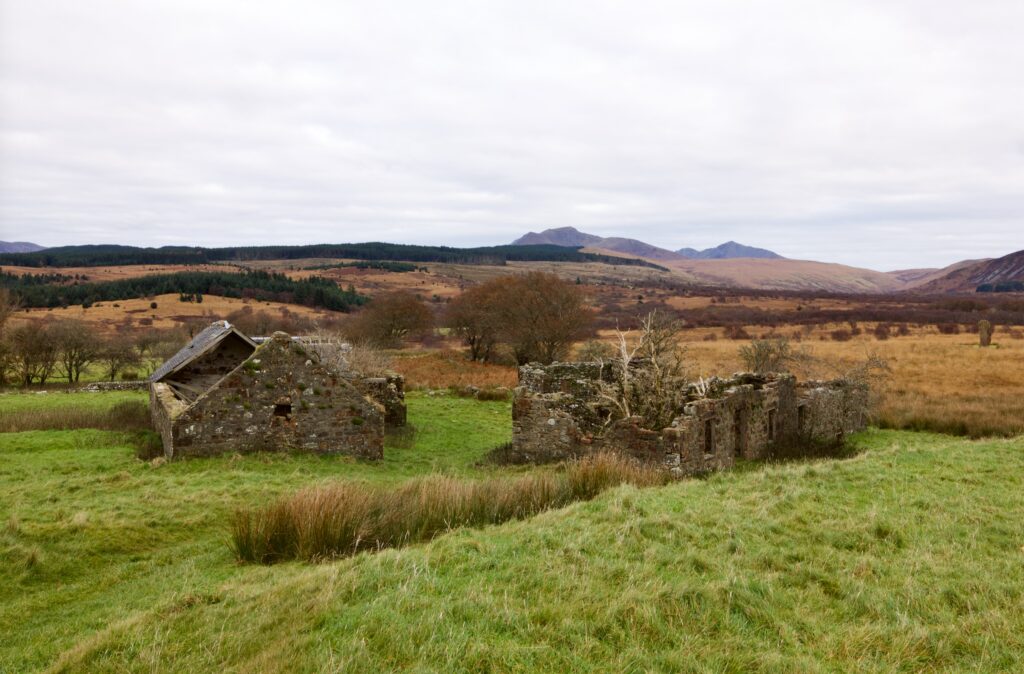
Moss Farm
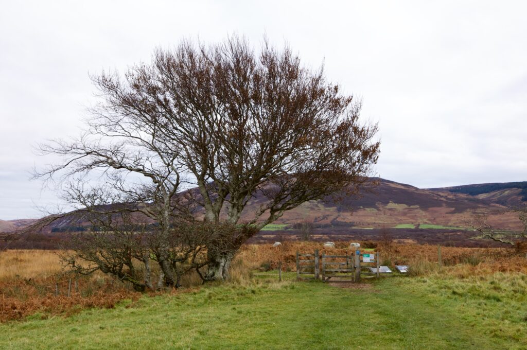
The path skirts the derelict buildings of Moss Farm, which are crouching in a hollow, and passes through a gate to another circle – although, with only four stones, it’s better described as a four-poster. Like Fingal’s Cauldron Seat, these are made of granite, and are pleasingly shaped with gently rounded tops. I feel they’re crying out to be called Fingal’s dumplings, because he must have made them ready to put in his stew and then for some reason forgot about them.
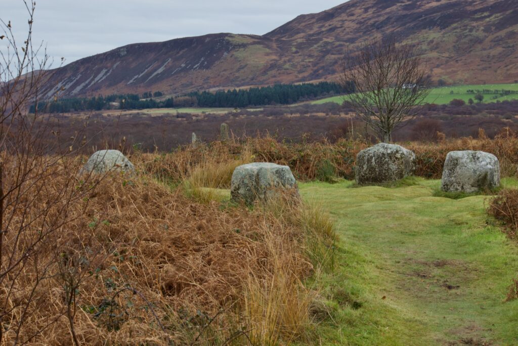
The four-poster ‘circle’. James Bryce dug here, too, and uncovered a cist containing traces of an inhumation, a food vessel, a bronze awl and some flints.
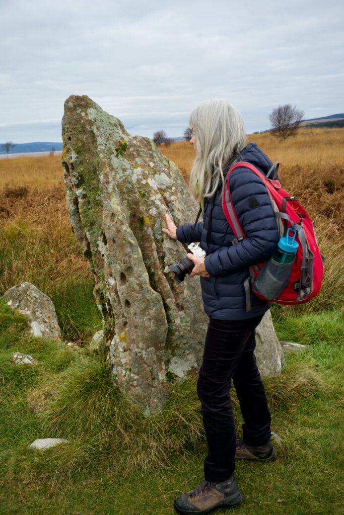
From here, it was just a giant’s hop over to the circle that had been drawing our eye for a while, because of the size of its one remaining upright stone. This is hewn from red sandstone, and rises to a height of over 13 feet. Sandstone weathers much more easily than granite, and the rain has channelled grooves down its upper surface. Stripes of lichen continue the lines, almost as if they’re creating their own work of art.
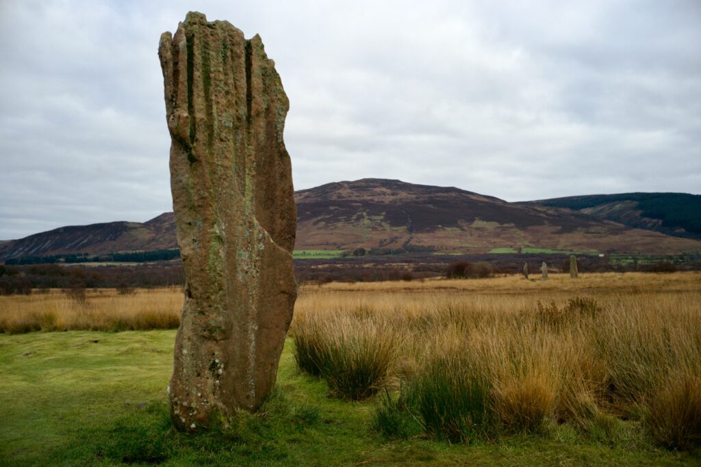
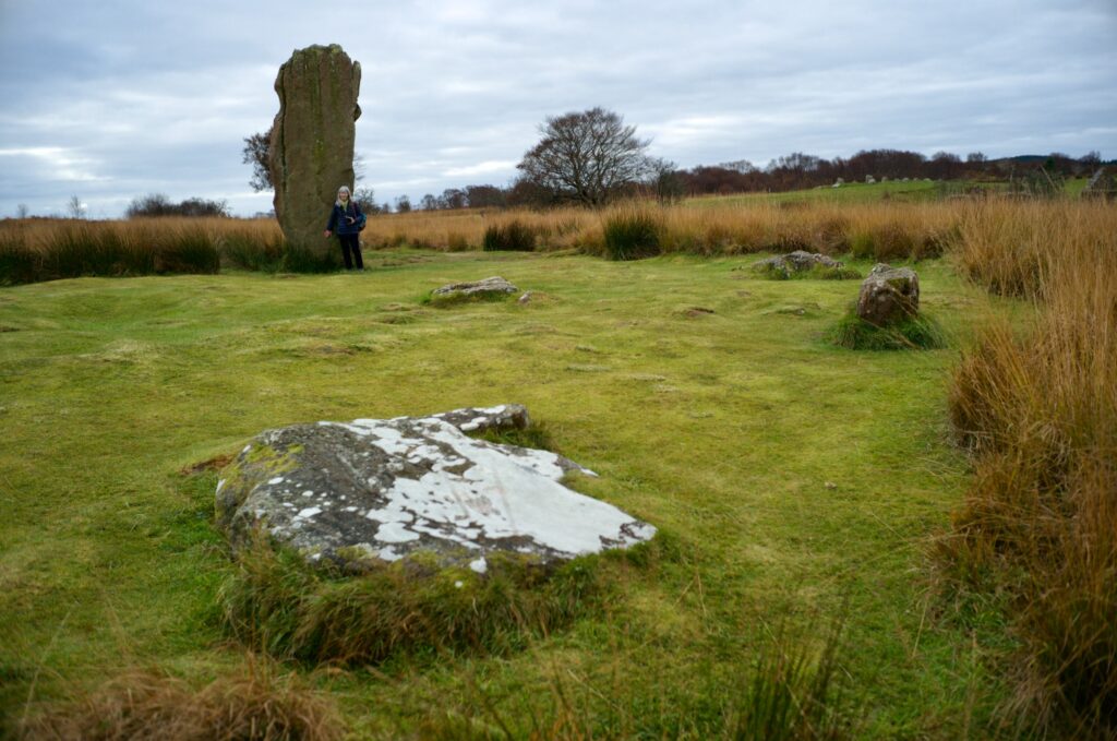
There were once nine stones in this circle, but over the centuries it has been liberally plundered for stone. All that remains of the tall stone’s companions are stumps, broken off at ground level. The burrowing Dr Bryce was busy here too, and found at the centre of the circle a cist containing a pot which immediately disintegrated, no doubt to his horror; he also found evidence of a crouched burial and a scatter of flints.
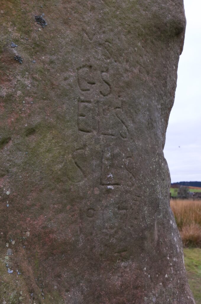
The tall stone has been carved with graffiti, including a list of initials and the date (I think) of 1917. I wonder if these are the initials of men lost in the Great War.
Just a few minutes’ walk from here is another circle, this time with three behemoths still in place, one them taller than any we’d seen so far. Red sandstone again, corrugated by rain and furred with lichen, they are the survivors of a seven- or eight-stone circle that enclosed two burial cists. On the ground close by are two flat stone discs about two feet across, one of them holed and broken into three fragments. These are the result of an 18th-century attempt to make two millstones out of one of the fallen stones.
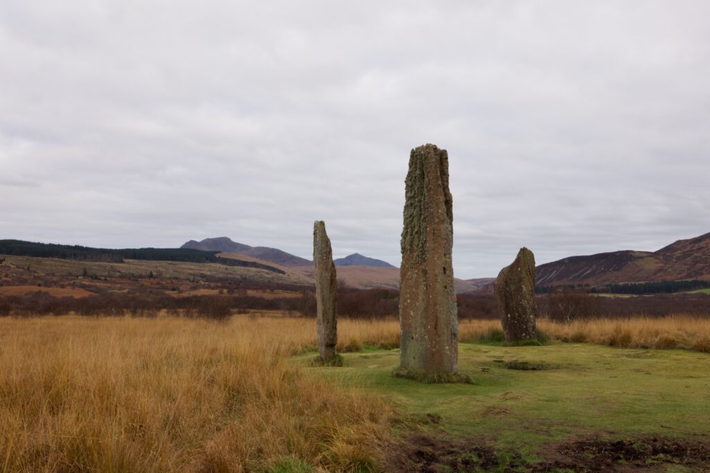
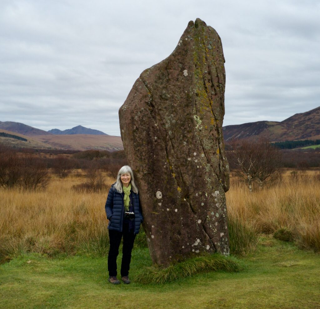
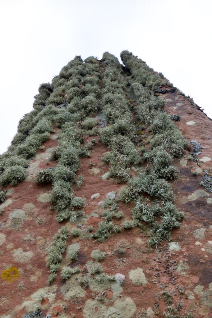
This skyscraper rises to about 18 feet
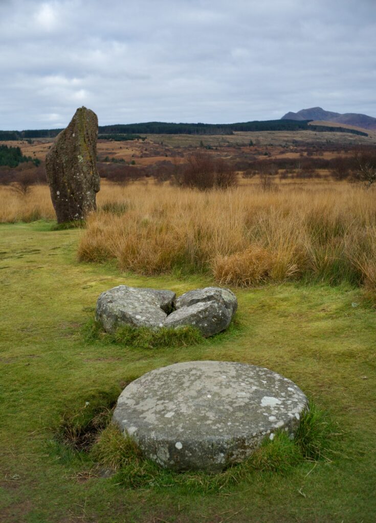
The unsuccessful millstones
Unbelievably, two further circles still lie beyond: both contain much smaller stones, and one features an alternating pattern of granite and sandstone. Excavations have shown that both these circles were preceded by rings of timber posts put up around 2500 BC. In the short-cut turf of the second, I noticed that even the grass seemed to be growing in circular patterns.
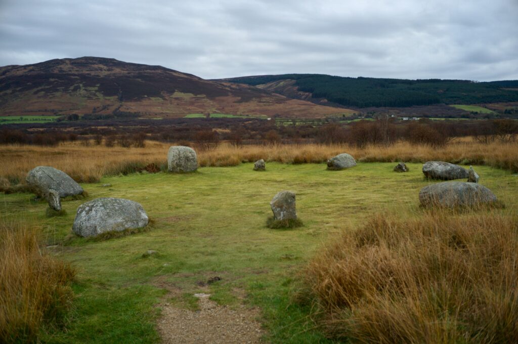
Above: The circle with alternating sandstone and granite stones
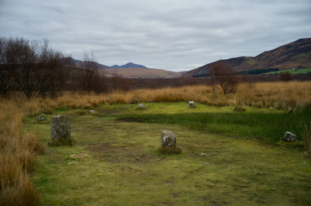
The smallest circle, and the last on the path, with Goat Fell on the horizon
But what happened to these compulsive circle-builders? Information boards at the site explain that they moved away from Machrie Moor at the end of the Bronze Age, around 800 BC. Exactly why they did so is still a matter for conjecture. The landscape that they farmed was fertile and arable, but the traces of their existence now lie beneath a layer of peat so thick that it engulfed some of the smaller stones. Is this what drove the inhabitants away? If so, what caused it?
Peat formation occurs in waterlogged conditions, as a result of the incomplete decomposition of plant material. One factor could have been a shift to a wetter, cooler climate, but some historians also point to soil deterioration caused by a ‘slash and burn’ approach to woodland clearance.
Even the timeline of abandonment is uncertain. Archaeologist Alison Haggarty, who published a paper on her excavation of two stone circles in 1991, observed that ‘after the stone circles fell into disuse but before peat began to form over the sites there would appear to have been another phase of farming activity.’ She concluded that ‘on this site, abandonment and peat initiation are not easily defined events.’ Historic Environment Scotland makes a similar point, in that the exact roles played by a shifting climate, social changes and over-farming have yet to be determined.
Some researchers have noticed that the midsummer sunrise would have been visible from the stone circles in a notch at the head of Machrie Glen. Whether or not this influenced their exact siting, however, is impossible to say. I can find no evidence about significant lunar alignments. Historic Environment Scotland says: ’It is not suggested that precise astronomical observation was attempted on Machrie Moor in prehistory. Instead it seems very possible that celebrations, rituals and gatherings of people from the surrounding countryside took place at midsummer or thereabouts.’
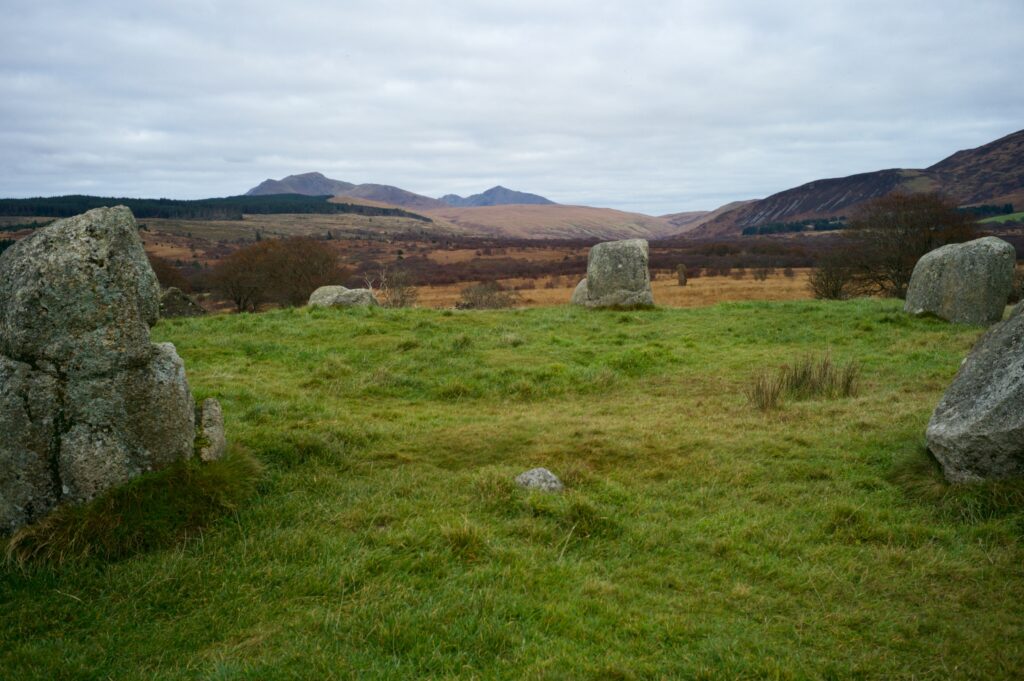
Looking north-east up the glen across Fingal’s Cauldron Seat
As for the energy of the place, it certainly feels abandoned, even before you learn about its history. While the cairns and stones in Kilmartin Glen have a quietly upbeat sense of wellbeing, and Calanais feels like it has a direct line to the gods, the circles at Machrie Moor seem empty, like the bones of a skeleton. Their life has soaked away into the ground.
We found a convenient spot to eat our lunch in the back yard of Moss Farm, whose decay is much more recent and relatable. It seemed as if we weren’t the first people to do so: I found an old glass bottle, perhaps for beer, tucked into the stone wall and providing a home now for vivid green mosses. I wonder what it was like to live here as a tenant farmer in the 1800s. You think about the famines of that century, the unimaginable pressures on rural families, and it’s too tempting, perhaps, to wonder if some pattern from the ancient past was repeating itself.
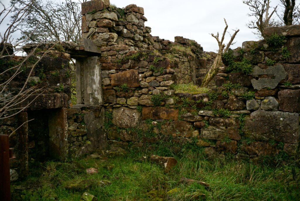
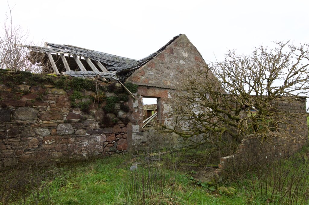
An elder tree grows in the back yard of the farmhouse, and ferns flourish in the walls. From what I‘ve read online, Moss Farm was rented out as very basic holiday accommodation in the 1930s, and was inhabited until sometime in the 1960s.
In his book on Arran, historian Thorbjørn Campbell considers the old Gaelic place-name for this area: Sliabh nan Carraigean. This has been translated as ‘the moor of the standing stones’, but he suggests an alternative derivation of Carraigean based on the Breton-French word Korrigan, an evil sprite that haunts locations such as the stone rows at Carnac in Brittany. With this interpretation, the place-name would mean something more akin to ‘the moor of the stone-ghosts.’ I can find no reports of hauntings at Machrie Moor, although there is an account from a local farmer who admitted to seeing ‘strange lights’ on the moor over the years.
Would I spend the night here? No.
And then finally, there’s a tradition about Machrie Moor that takes a plausible historical event, weaves in some figures from Irish mythology, and crowns them with a garland of Victorian melodrama. Writing in 1873, the antiquarian John MacArthur recounted a local story that the Irish hero Fionn Mac Cumhaill (whose cauldron we looked at earlier) and his band of warriors, the Fianna, were hunting boar over the neighbouring hills when they noticed a fleet of Norse ships approaching the shore. Immediately, they abandoned the hunt and raced down to repel the invaders, chasing most of them back to their ships. A few who got away were pursued all over the island and slain near an old fort called Dunfiun* or Fingal’s Fort. Exactly where these unlucky Norsemen were buried MacArthur doesn’t say, but those of Fionn’s men who died in the skirmish were given honourable burials on Machrie Moor ‘and the huge stone columns, now half-concealed amid the tall heath, were raised in circles around their graves to the mournful song of the bards.’ I feel as if that scene would have appealed directly to Tennyson, and his ‘last, dim, weird battle of the west.’
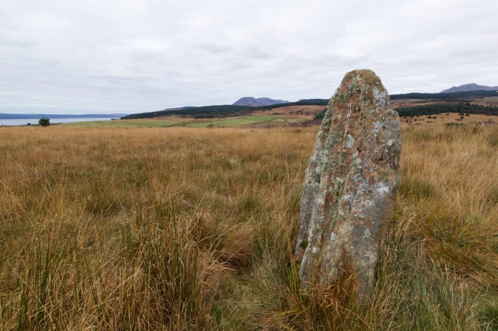
We had plenty to think about on our walk back to the car; not least because Colin had noticed another standing stone, off to the right, which rewarded us with a great view of the sea and the distant coast of Kintyre. I was almost suffering from megalith overload, which isn’t a familiar complaint, and I had a feeling that it would be a job and a half sorting out the photos when we got back. The light was beginning to fail when we caught the last ferry at 3.45, but we still stood out on deck and were delighted to see the ship surrounded by scores of dolphins, which leapt and dived for several minutes until we’d passed out of their fishing grounds and into shallower water. Fionn and the Fianna, perhaps, still hunting in the underworld? I don’t know. But if I was going to look for them, I wouldn’t look in the moor of the stone-ghosts.
*Dunfiun or Dun Fionn is a hill fort, presumably Iron Age, on the east coast of the island, near Brodick.
–
Reference and further reading
- Thorbjørn Campbell, Arran: A History (2013)
- Aubrey Burl, The Stone Circles of the British Isles (1976)
- D Robinson, ‘Possible Mesolithic Activity in the west of Arran: Evidence from Peat Deposits’, Glasgow Archaeological Journal, 1983
- Alison Haggarty, ‘Machrie Moor, Arran: Recent Excavations at Two Stone Circles’, Proceedings of the Society of Antiquaries of Scotland, 1991
- Historic Environment Scotland, ‘Machrie Moor Stone Circles and Moss Farm Road Stone Circle,’ Statement of Significance (2004, revised 2026)
- Historic Environment Scotland, ‘Machrie Moor Standing Stones’ history and stories
- Historic Environment Scotland: a new circle at Machrie Moor discovered in 2022
- The Northern Antiquarian
- John MacArthur, The Antiquities of Arran (1873)
Further note: The main sites at Machrie Moor are officially numbered 1 to 11 (an additional, buried circle was discovered in 2022, and is numbered 12). However, there seem to be discrepancies depending on which website you visit, and I suspect one of the information boards at the site has got 1 and 11 mixed up. To avoid confusion, I’ve left them out.
Images copyright © Colin and Jo Woolf